Walking Pinellas Beaches: Day 5 – Fort De Soto Park
Today’s Walk
Start / End: Fort De Soto Park – Fort De Soto Park
Distance: ~4 miles / 8,657 steps
Time: 1 hours, 26 minutes
If I could offer just one piece of advice to anyone considering a similar coastal walk, it would probably to not sleep in a hot tent on a pile of shells after walking 40 miles in four days – particularly if you plan to walk another five or six the next day.
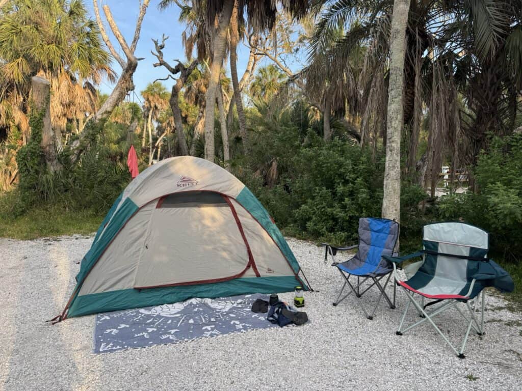
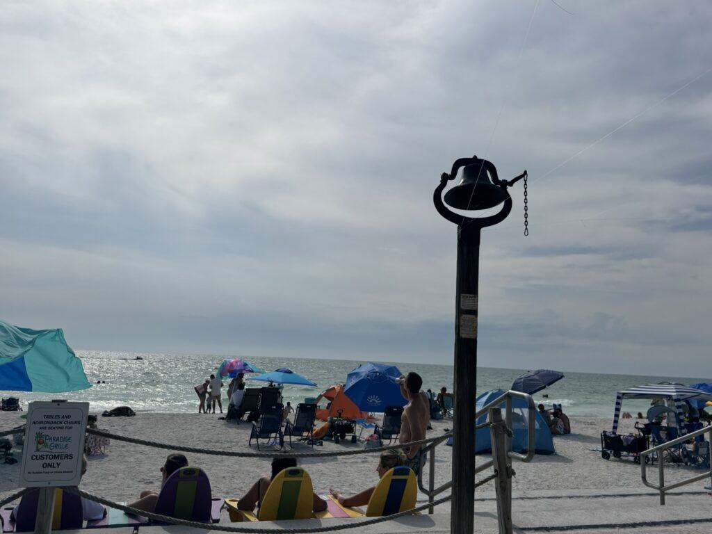
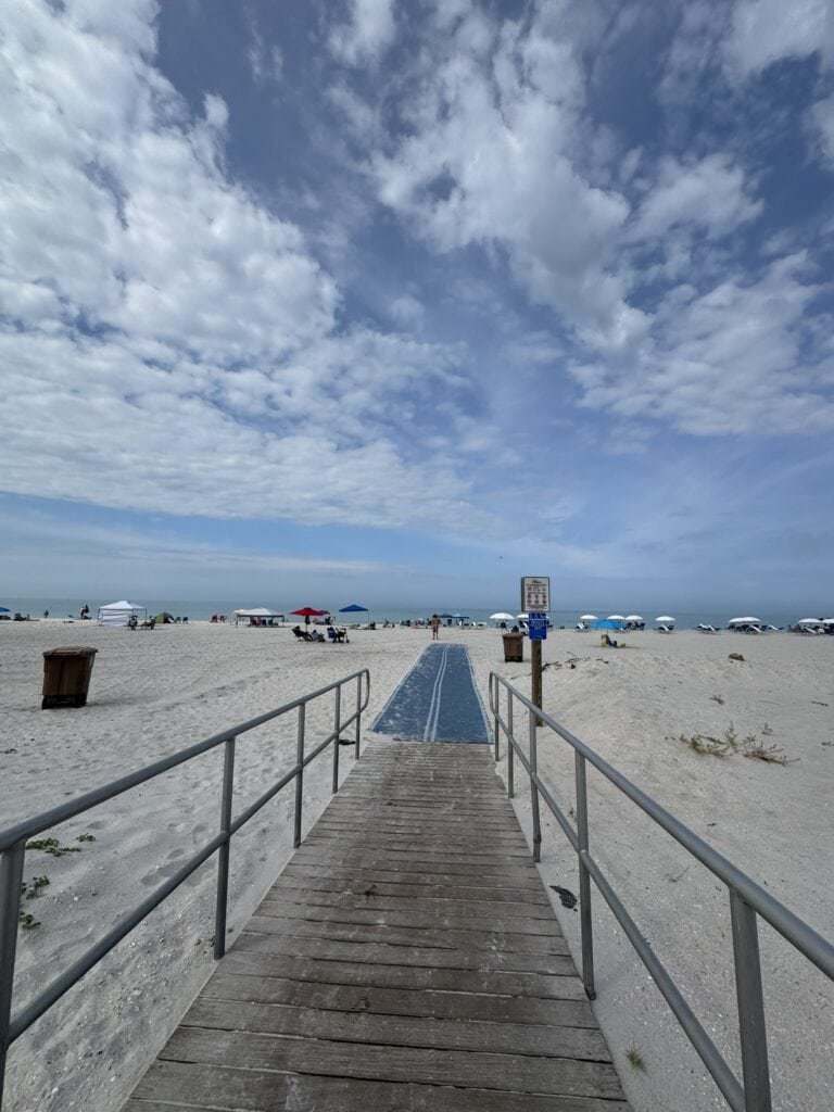
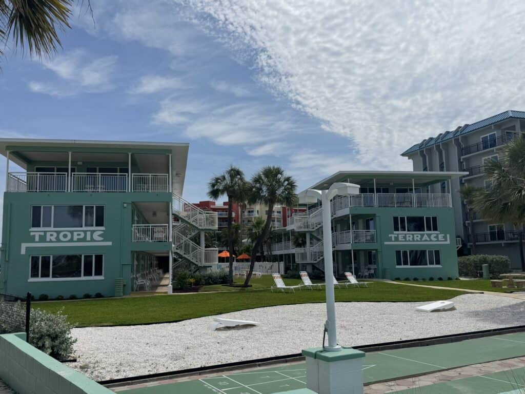
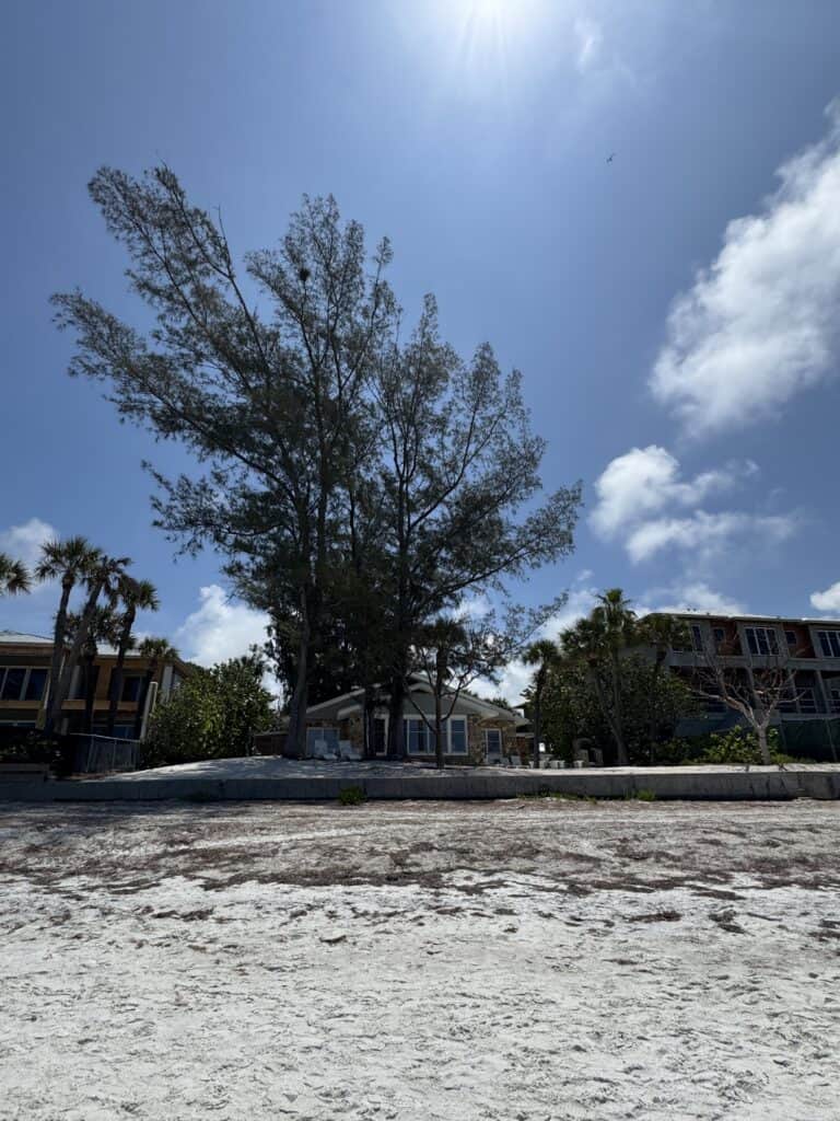
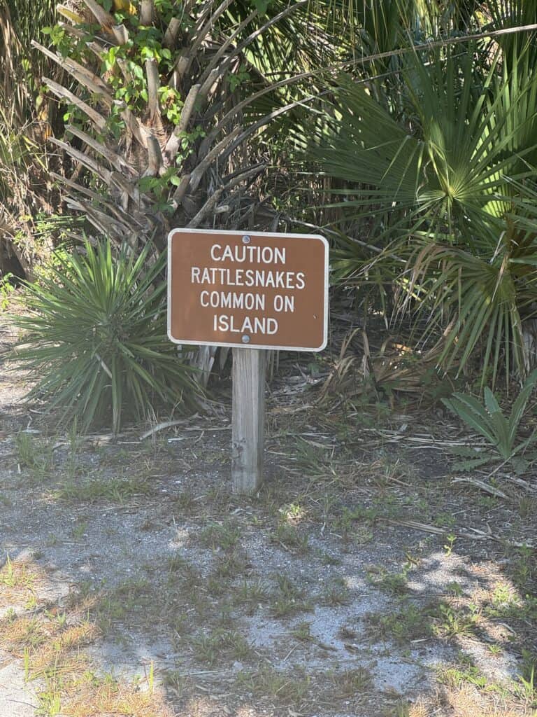
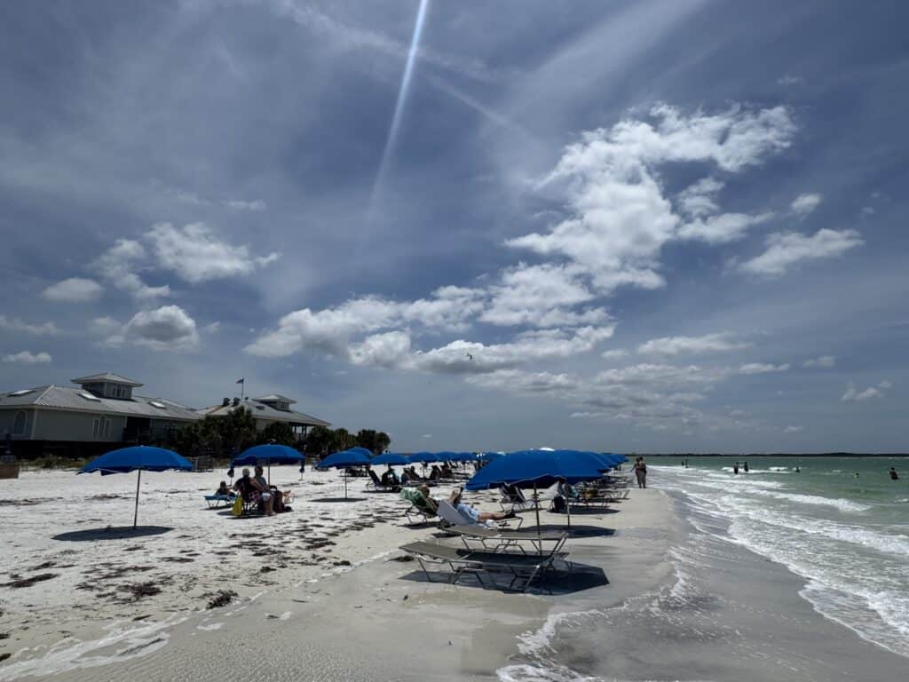
Don’t get me wrong. Fort De Soto Park, where Morgan and I camped for the final night of my walk, is gorgeous, and the beachfront campground where we stayed is among the most popular in the country at some times of year.
The “De Soto” in Fort De Soto comes from Hernando De Soto, a 16th-century Spanish explorer who explored the area as part of an absolutely bonkers journey through the New World, before dying and getting a surprisingly large number of things named after him throughout the entire Gulf Coast. The “fort” is also quite literal; it was surveyed by a young Robert E. Lee (who also surveyed Tybee Island’s Fort Pulaski, where I spent a bit of time back in 2022), who recommended the area be fortified.
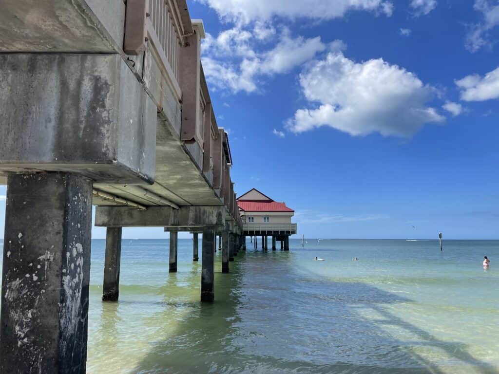
Today, it’s got two fishing piers, a museum, a snack bar, and a variety of other amenities that make it punch way above its weight when it comes to county parks. But by the time we arrived around 6 on Saturday evening, I wasn’t much in the mood to see any of it.
Although I was dreading the setup process, it went surprisingly easily with Morgan’s help. Setting up the tent alone to test it out before I left had been nothing short of an ordeal, but with another person, we were done in minutes. There’s something to be said for that, I think.
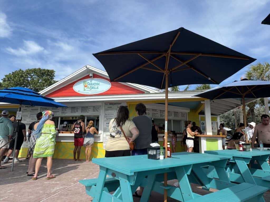
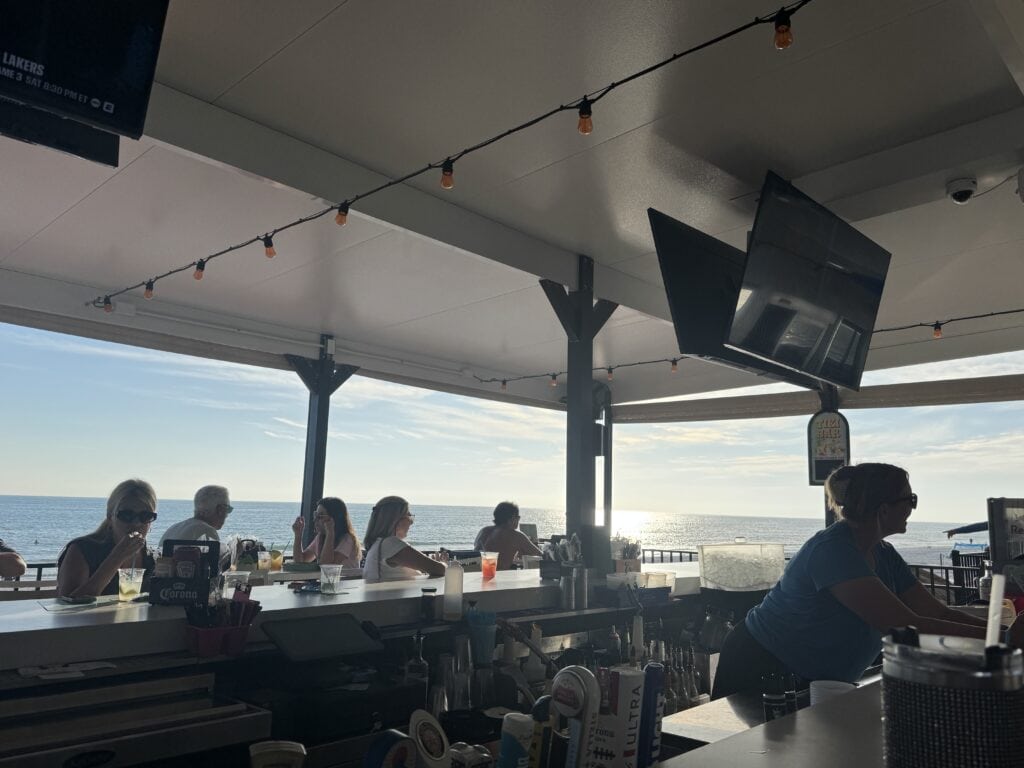
Still, I was in a less-than-ideal mood. I had been riding a bit of a high since finishing the day’s walk, a somewhat unexpected outcome if you’d asked me in the morning. A double rum runner at Paradise Grille on the Pass-a-Grille beach (street parking, $7/hour) also didn’t hurt.
But now, the issues began to stack up. My feet were so swollen I couldn’t fit them in my shoes, nor did I want to try to squeeze them in there with the amount of sunburn they had. My left shoulder, which had bothered me for most of the trip, had now almost entirely frozen up. And I was sunburned basically everywhere that had been exposed to light at any point over the preceding days; I’ve now accepted the fact that there is no level of SPF/UPF, nor frequency of application, that can protect my skin from extended time in the midday Florida sun.
We treated ourselves to a nice seafood dinner at a restaurant near the park, but headed back relatively early. The night is long outdoors, and we wanted to settle in. We both had plans for the evening; Morgan had picked us up a box of wine, and I was going to work on the blog while she caught up on some reading. In reality, we both crashed pretty early. I’d be surprised if either of us even made it to 11:30, lulled to sleep by the dull roar of campers in nearby campsites.

Temporarily lulled, I suppose. I felt like I was awakened basically every hour after that by one thing or another, from late-night music to a group of fearless raccoons I saw scamper up a tree.
When I finally awoke for good when it was too bright to ignore, the decline had continued. The next unexpected casualty were my lips, which were swollen and sunburned enough to make speaking sound as ridiculous as it was painful. An excellent capper for the final day, and truly the only day I had planned to do any talking.
That’s because my parents were driving up from Southwest Florida to meet Morgan and me for a day at the beach. I’ve always remembered my dad taking walks when we were at the beach (although not to the extent I was doing, certainly), and he’d expressed interest in joining me on the final day. As an added bonus, it was Mother’s Day, and I’m grateful to be close enough to get to spend time with my Mom on days like these.
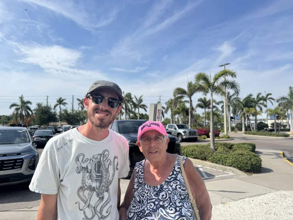
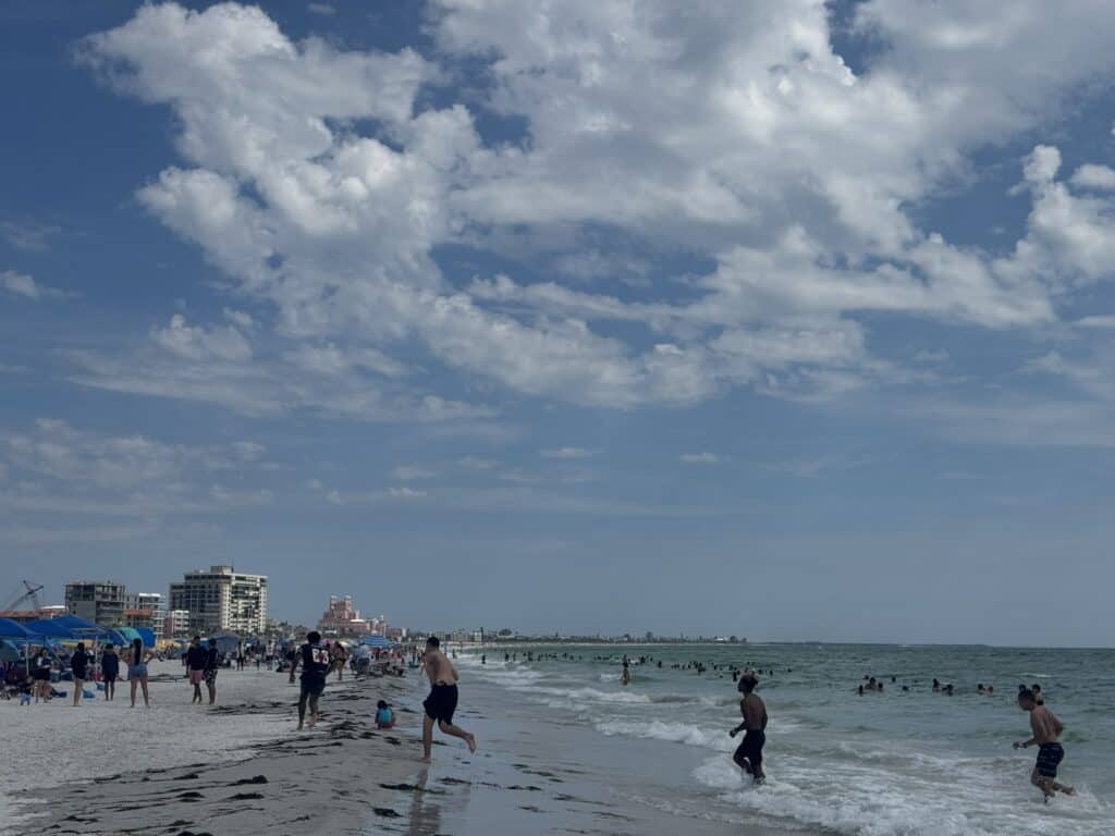
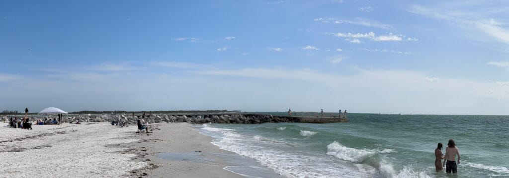
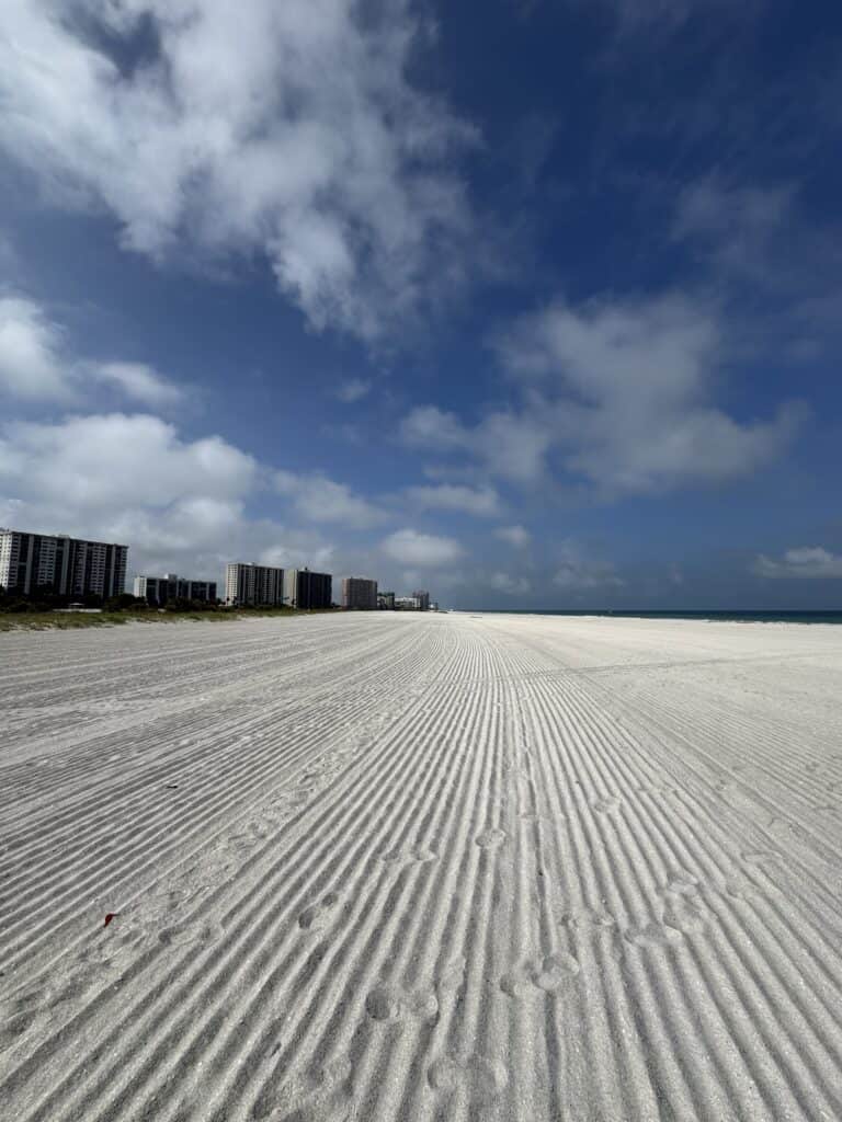
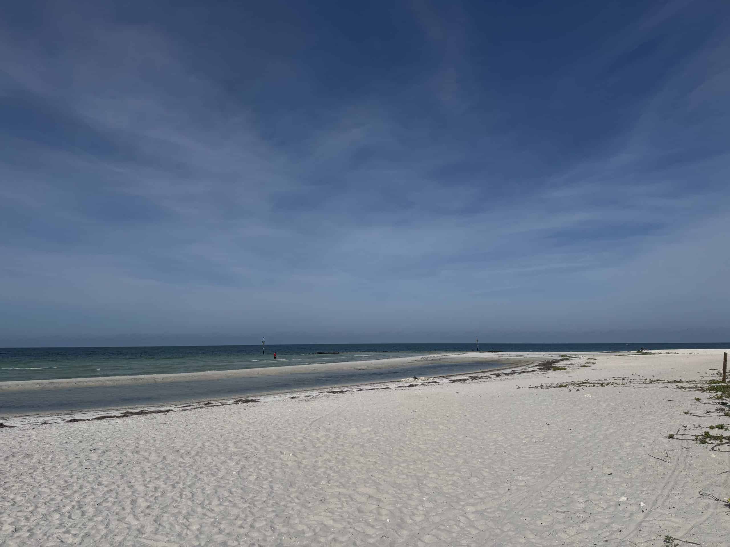
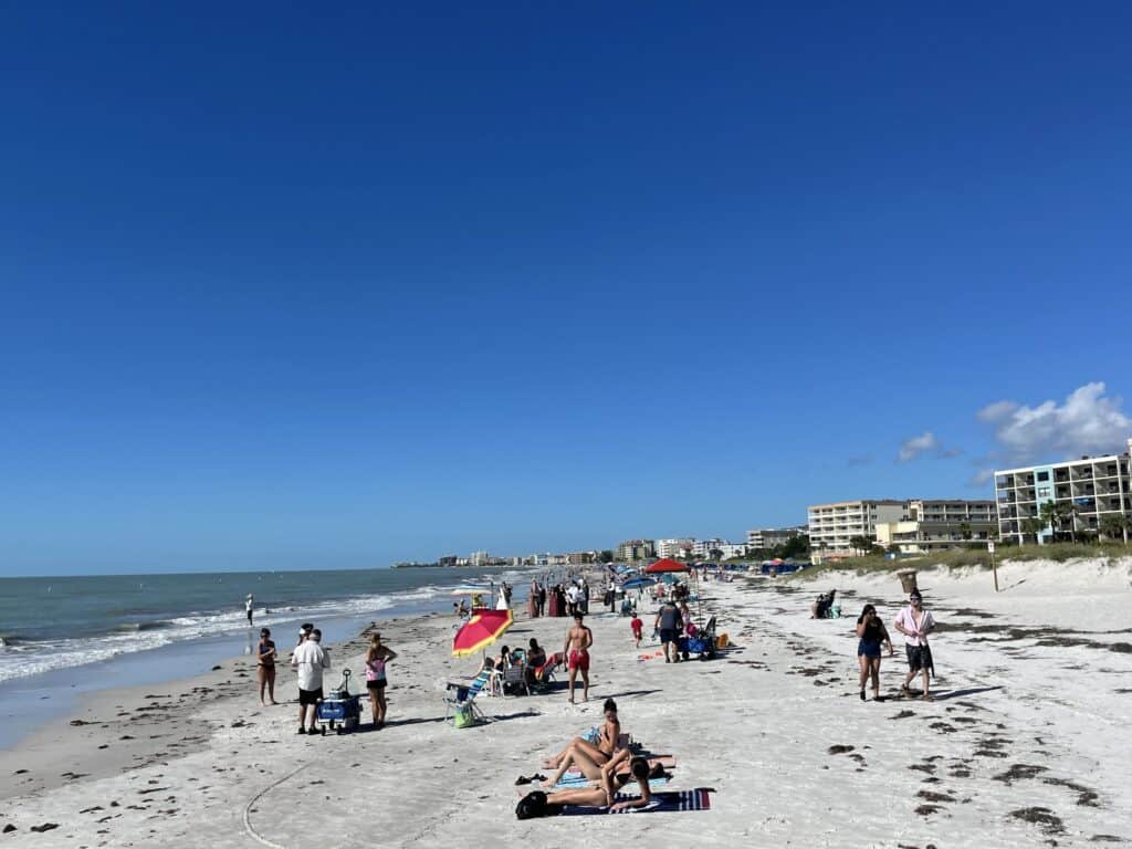
They arrived shortly after we finished packing up our campsite, and I hobbled over to meet them in the parking lot. This was not going to work. My initial plan had been to have Morgan drop my dad and me off at the park’s North Beach, and we’d walk back to the area where she and my mom had set up for the day, then walk beyond to the east end of the park. But it was very clear that wasn’t going to be possible with my feet in the condition that they were, not to mention a humidity level that had me sweating through my shirt before we even reached the beach.
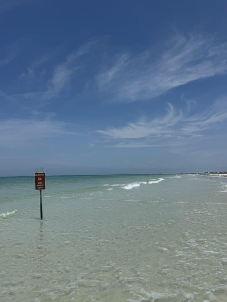
Even my backup plan, which was to just walk east, to at least complete the walk at the very end, with the Skyway bridge looming ahead, was foiled by a large roped-off section of beach in that direction, making the area beyond relatively inaccessible without a detour on park roads. All in all, the combination of physical pain, lack of sleep, and mental frustration had me in a pretty bad mood, despite the best efforts of Morgan and my parents.
I felt extremely defeated. I’d come so close, spent enough time, and endured enough discomfort for no discernible payoff other than an internal one, and I wasn’t even going to truly be able to finish.
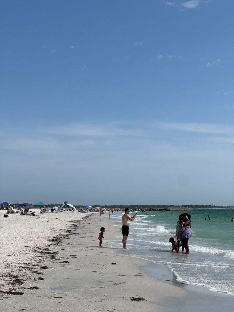
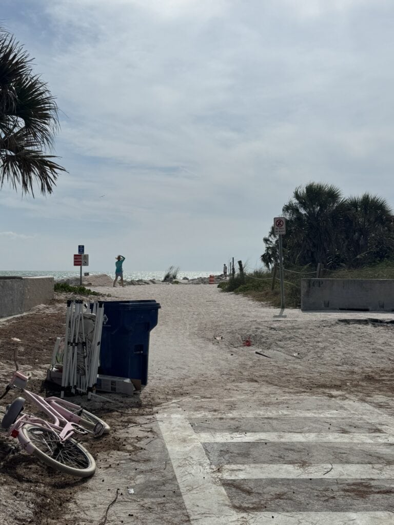
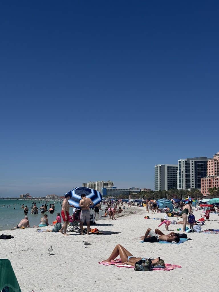
Finally, I was done stewing. It was time to do something, at the very least. I was, after all, at the beach, a beautiful one, with my girlfriend and parents. So I grabbed my bag, sprayed on another coat of absurd mango-coconut sunscreen (lesson learned: check the sunscreen bottle for more than just the SPF), and my dad and I set off up the beach toward the northern edge of the park.
As much as I’d struggled before, I was surprised at the ease with which I was walking. Swapping out a heavy pack full of clothes, gear, and supplies for one with a bottle of water and sunscreen is likely to do that, I suppose. I felt free again, and as we walked and talked on a beautiful day, with crystal-clear blue water at our feet, it was easy to remember why I’ve always loved walking on beaches as long as I can remember.
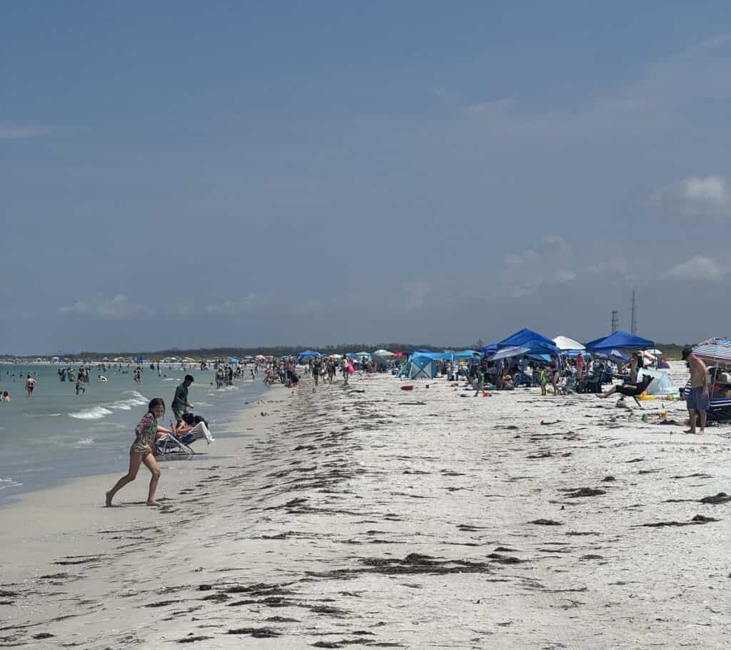
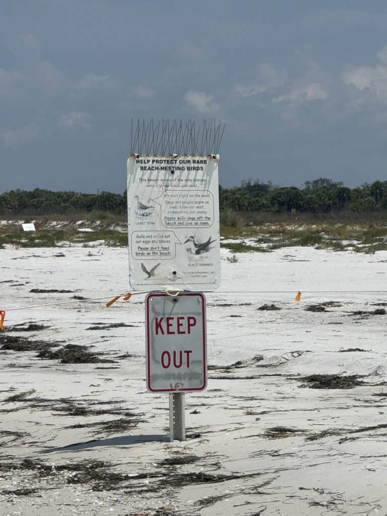
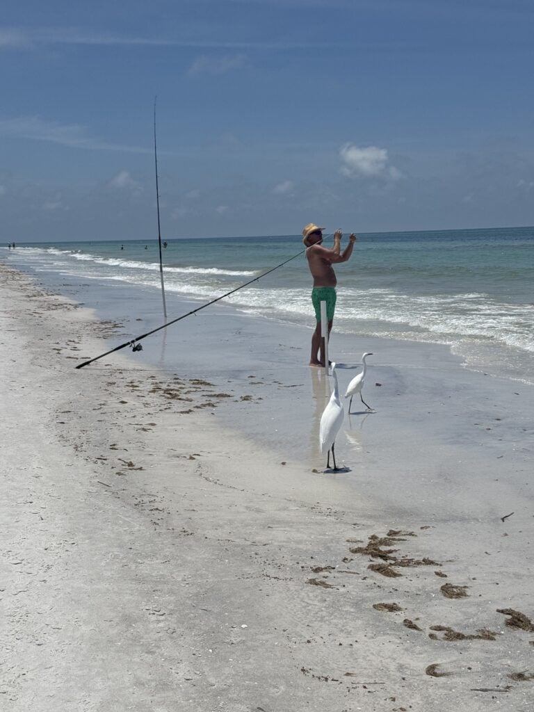
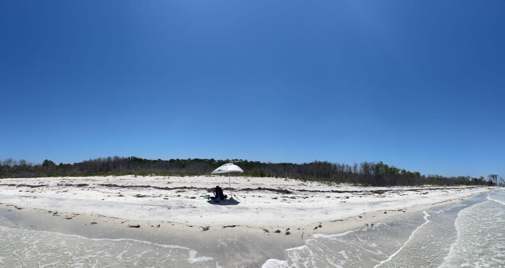
We strolled past the crowds near the entrances, past the quieter portions with only a patchwork of beach tents and surf fishermen (the scourge of beach walkers everywhere), and onto the nearly completely empty part of the beach. But as the cluster of umbrellas at the northern tip of North Beach crept closer, we encountered what would prove to be our stopping point.
A rope was strung across the sand between a series of signs, stretching all the way out into the water. A helpful volunteer, who had the tough job of sitting at the edge of a remote beach keeping wanderers from harassing birds, came over and explained the protected nesting area extended many feet offshore because, as she put it, the birds use the water too.
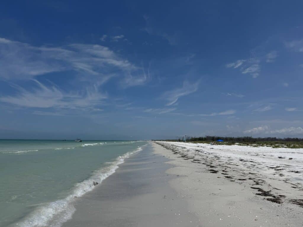
It dawned on me that, even if I’d tried to do or been able to do the most literal version of my walk, I would have faced major hurdles in Fort De Soto anyway. Miles-long turnarounds. Long stretches on surprisingly busy park roads. It would have been decidedly unpleasant, and as down as I still felt about not completing the walk to my full satisfaction, this made me feel a bit better.
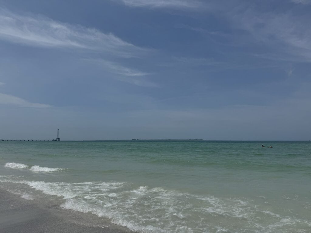
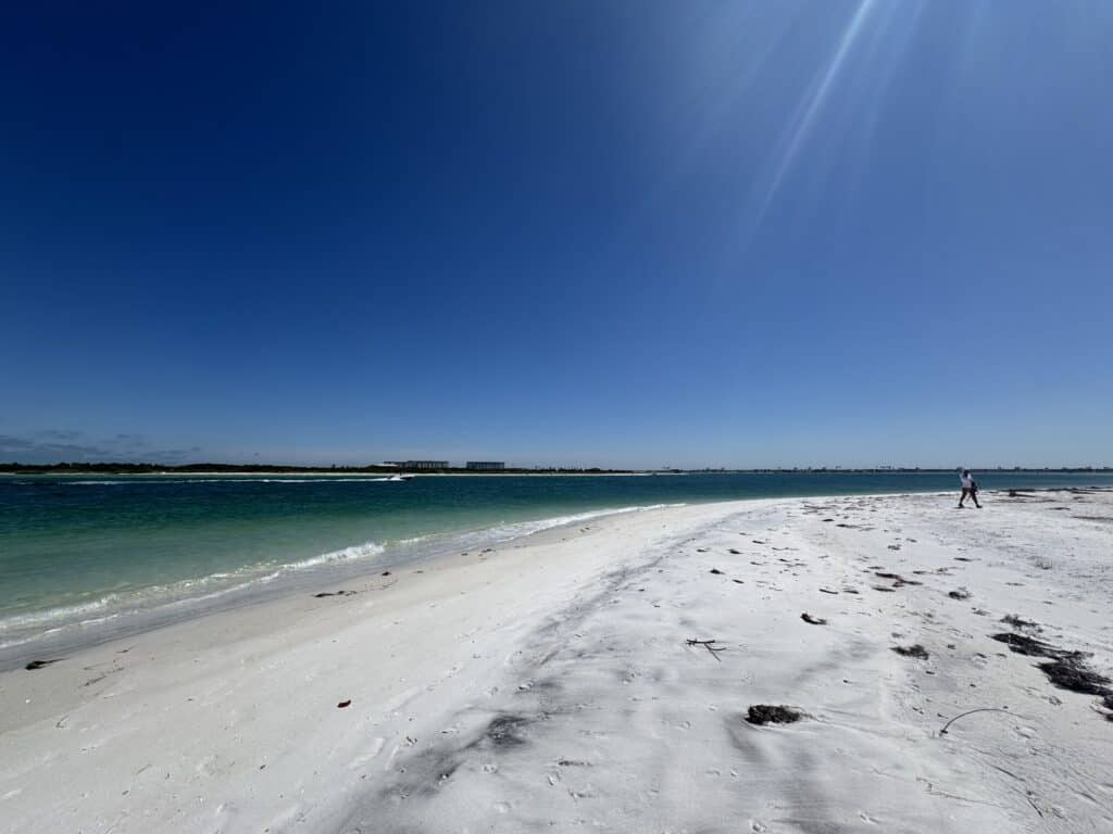
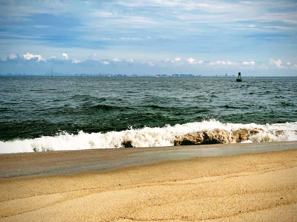
So, we turned around. We looked at Egmont Key offshore and considered how far it was to Bean Point Beach on Anna Maria Island, visible in the distance across the mouth of Tampa Bay. Just about five miles, it turned out; roughly the distance on Long Key between St. Pete Beach and Pass-a-Grille. Dealing with the unusual combination of long-distance visibility ahead, dense claustrophobia on one side, and wide-open spaces on the other can do wonders to shift your sense of distance.
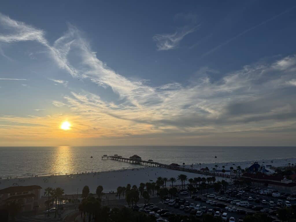
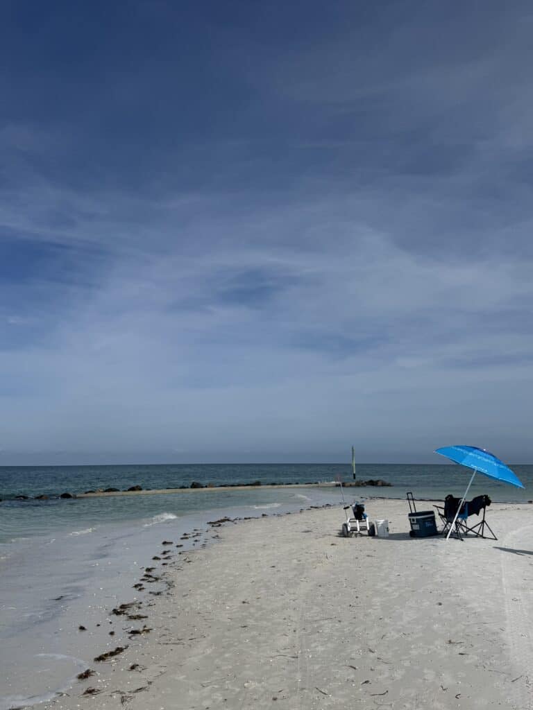
We arrived back at our beach camp near the fishing pier, now fully set up to provide Morgan and my mom some shade and a place to relax. That was as far as this walk would go. I wouldn’t see the Skyway from the tip of the east beach. I wouldn’t truly be able to say I walked it all, at least in one shot. But there was no changing that now.
There’s no doubt it was a bit of an anticlimax. I didn’t even take some wistful final image representative of my struggles and accomplishments. I didn’t even remember to take a picture with my dad as we got back to the chairs.
I have to shoulder most, or at least some, of the blame for pushing myself too hard, too far, and with too much unnecessary stuff in my bag, in the heat and the sun, for days three and four in particular. Long stretches were just not enjoyable ways to spend time, during what was supposed to be a fun, interesting achievement. One of my biggest regrets was not being able to spend more time in the actual communities themselves. Longer and more frequent stops and detours would have given me valuable time off the beach itself, but also provided a more complete picture of these beach towns.
Some of it was unavoidable. The circumstances of life didn’t present me with this opportunity when the weather was a bit cooler and the overall conditions not so intense. Some of it was eminently avoidable; in retrospect, it was dumb to assume that I could match the distance of my longer Jersey Shore walk days in more oppressive conditions, with less training, on legs that were five years older.
All lessons learned, for what Morgan kept referring to as “next time”. I’m not so sure there will be a next time, or what or when that would be. But it’s a lesson nonetheless.
It’s amazing how quickly it’s possible to make the transition back to normal life, even after a few days of abruptly leaving it all behind. I was back to working in the garden the same afternoon I got home, and back at freelance work and the job search the next morning. By midday Monday, the swelling in my feet had gone down enough that I could get my topsiders on, I could lift my left arm up without involuntary noises, and the various sunburns (other than my lips, which may be the most painful of lessons learned) had begun to change from fiery throbbing to dull annoyance.
As time goes by and my gait and skin tone return to normal, I hope I’ll remember the better moments of the walk more clearly than the struggles and frustrations. Fundamentally, there’s a different perspective underneath this walk, compared with my last one five years ago. Back then, it felt like saying goodbye; my last real connection with the state would be officially severed between the first and second halves of that adventure, when my parents sold the home I grew up in.
But now, I live here. In barely an hour’s drive from the southernmost point of this adventure, we were back home. I can, and hopefully will, go back to these places as many times as I want to eat at the restaurants, drink at the bars, browse the shops, and check out the landmarks, museums, sanctuaries, and other attractions I missed or couldn’t fit in along the way.
If I want to take the most optimistic view of this walk (and I don’t always want to do that, still), it was an introduction to some new friends and a brief chat with some acquaintances I’d met in passing before. It’s not reasonable to try to learn everything about someone in your first conversation, or even your tenth. In any case, the foundation for a good relationship has hopefully been laid. We do have a good meeting story, after all.
Walking Pinellas Beaches: Day 4 – The “Redingtons”, Treasure Island, and St. Pete Beach
Today’s Walk
Start / End: North Redington Beach – Fort De Soto Park
Distance: ~11.1 miles / 28,724 steps
Time: 6 hours, 41 minutes
Today’s Listens: “Graceland” by Paul Simon, “Aja” by Steely Dan
On day 3, I did not have a lot of fun. For something I’ve chosen to do voluntarily, and of which I have total control, this was stupid. So for day 4, I decided to change that.
This is no doubt a case of mind over matter, because as soon as I stepped outside, I was struggling. The humidity was borderline unbearable by 9, and there wasn’t even a hint of a breeze. Emergency measures had to be taken. Then, a sign from above that someone actually wants me to finish this trek.
I came upon the Madeira Beach post office, and, despite the general suspicion of the alternately extraordinarily chatty and mean clerk, mailed some of my unneeded stuff back home. This was a trick I’d picked up on the Jersey shore walk, although I still apparently didn’t learn the lesson of not overpacking. A few pounds out of my pack was instantly noticeable, and I suddenly had a new respect for those ultra-light backpackers who measure their bags down to the ounce.
In a minute, I was back on the beach via Archibald Beach Park – yes, a public beach access with public parking and actual amenities like bathrooms, showers, and places to sit. In all sincerity, this felt like a novelty after the inaccessibility of the day before.
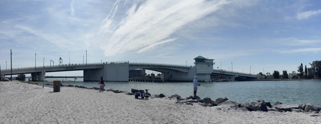
Despite this, I was struggling. I spent the entire two miles to John’s Pass bargaining with myself about how much I could or would actually do that day. I was still doing this until a large iced coffee and a drawbridge saved the day, perhaps literally.
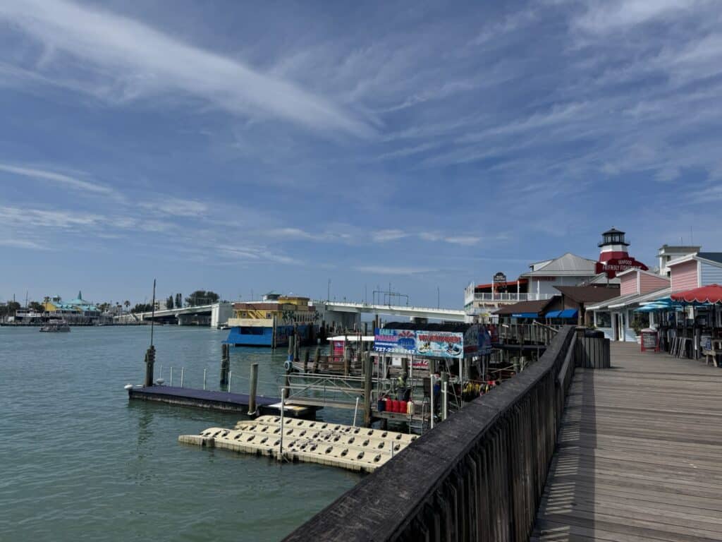
The iced coffee came from a relatively nondescript cafe in John’s Pass, an unusual combination of Old Florida and Tourist Florida in the form of a mixed development of commercial and recreational boat slips, large and small restaurants, tacky souvenir shops, and respected local artists and craftsmen. You can rent a kayak and paddle into the mangroves on the back side of the island, followed by a dinner of local seafood, or you can grab a ride on the party boat that looks like an old-time riverboat and eat at the Hooters location with the World’s Largest Chicken Wing. I quite like the area overall.
After dawdling and wandering a bit through the area, I found myself approaching the bridge across the pass as red lights began to flash and swinging arms came down across the roadway and sidewalk. I’d been caught by the John’s Pass drawbridge, which, ludicrously in my estimation, doesn’t open on a designated schedule, but on demand to any boats needing to get through. Supposedly, this has something to do with the speed of the currents in the pass, but I’m not sure that’s much comfort to the looooong line of cars backed up down Gulf Boulevard on a prime beach Saturday.
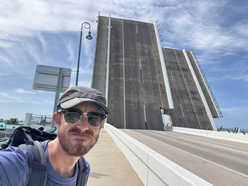
For me, it was probably the best thing that could have happened. It forced me to stop, finish my coffee, and cool off in the stiff breeze blowing off the water. Why not finish the next island and see how I feel?
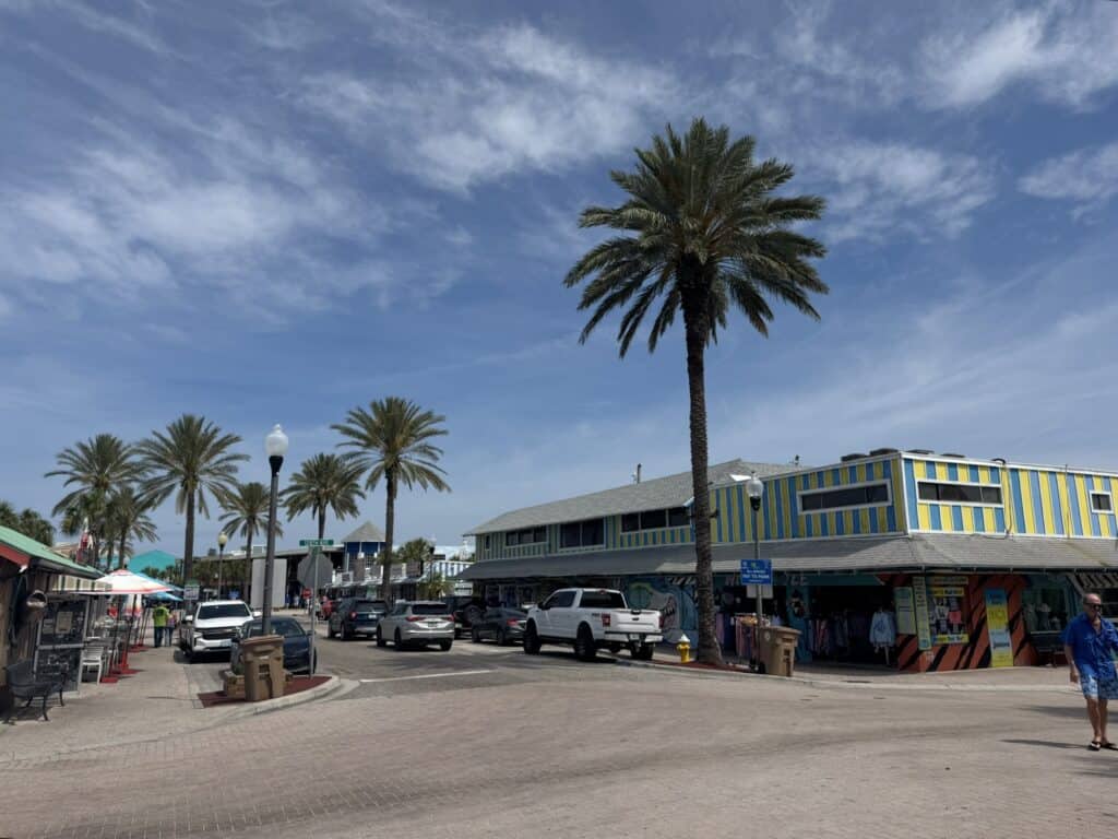
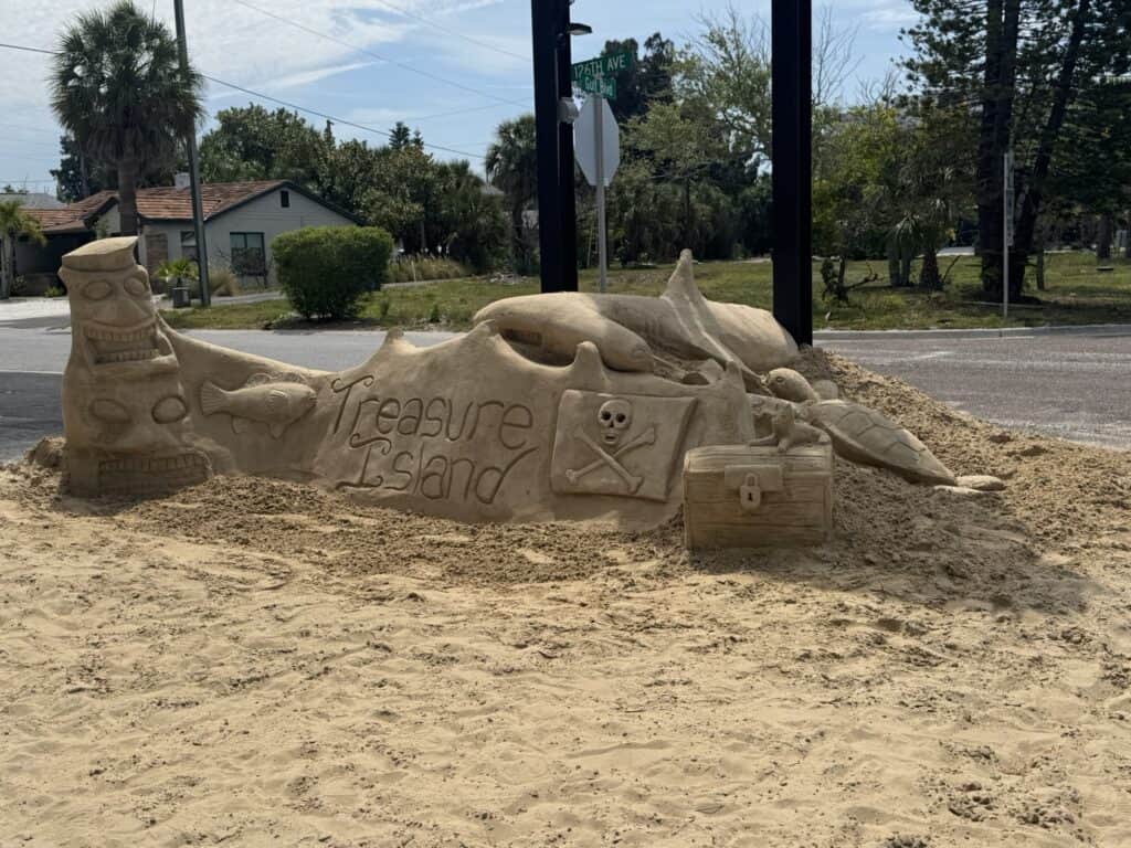
And that’s exactly what I did when the bridge (eventually) lowered, and I trekked across to arrive on Treasure Island, a community that, in my estimation, is as charming as its name (even if the entrance sculpture isn’t actually sand).
Part of my second wind upon reaching Treasure Island, admittedly, was leaving the beach for stretches. This is a beach walk, true. But what was sorely missing on the previous day was any sort of connection to the towns I was walking through. For as much as I interacted with the Bellairs and Indians, I might as well have been in New Jersey, or California, or Australia, or anywhere else with sand and water.
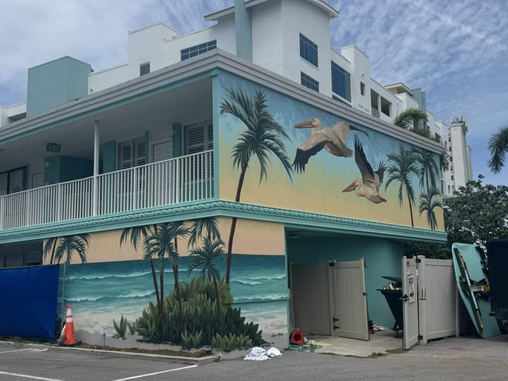
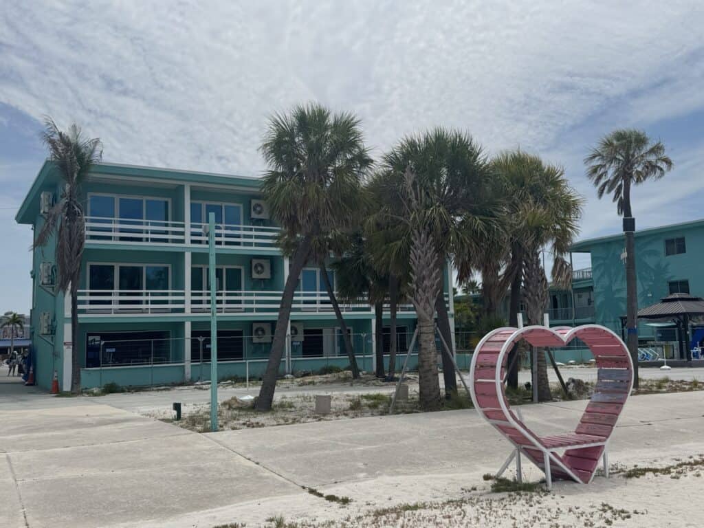
I decided to change this with Treasure Island. I didn’t know much about it before my walk, to be honest. But I was completely charmed by the character of the place: small, old-school beach cottages, authentic retro motels, and lots of shops, restaurants, and bars; the first town with a distinctive character I’d encountered since Clearwater Beach. You’re able to take it all in, along with some beautiful beach views, along a paved “Beach Trail” that runs between the expansive sand and the motels.

The one thing they almost all had in common? They weren’t open. It was apparent that one of the back-to-back hurricanes that affected our area in 2024 (who can even tell anymore?) had done some serious damage, and the owners of these august establishments had yet to pull together the contractors, money, or will to fix them. In any case, that’s two winter peak seasons missed now for many of these spots.
I’ve tried not to dwell too much on the doomed nature of a lot of these places as I pass through them. I think a lot about hurricanes, generally, for both personal and family reasons, as well as the general specter they cast over summers here. But as I proceeded further and further south toward Milton’s landfall, and residential development hugged the water closer and closer (victims from the storm surge from Helene), it was hard to ignore.
Despite all this, Sunset Beach, at the southern tip of Treasure Island, still had a lot of charm, even if the differences in style of home and phase of rebuild were stark.
As I walked back onto the beach itself to reach the southern tip of the island, a banner on a tent caught my eye.
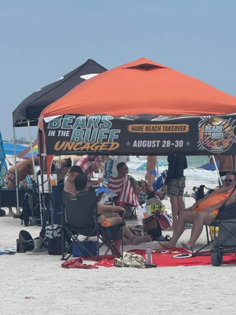
It took me a second to parse what this meant, but when I did, I was instantly glad I hadn’t planned this walk for late August. I’d seen enough unwanted and unexpected nudity at Sandy Hook on my last walk. It was this same moment when I realized the extraordinarily large number of men (and only men) around me on the beach, with a far higher speedo quotient than I’ve seen in North America. Go figure – I’d stumbled across the most popular gay beach in Pinellas County, another fact my (apparently quite incomplete) research hadn’t turned up about Treasure Island.
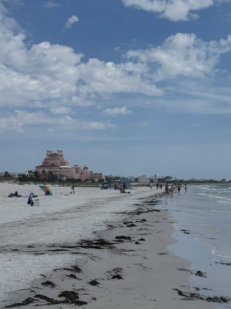
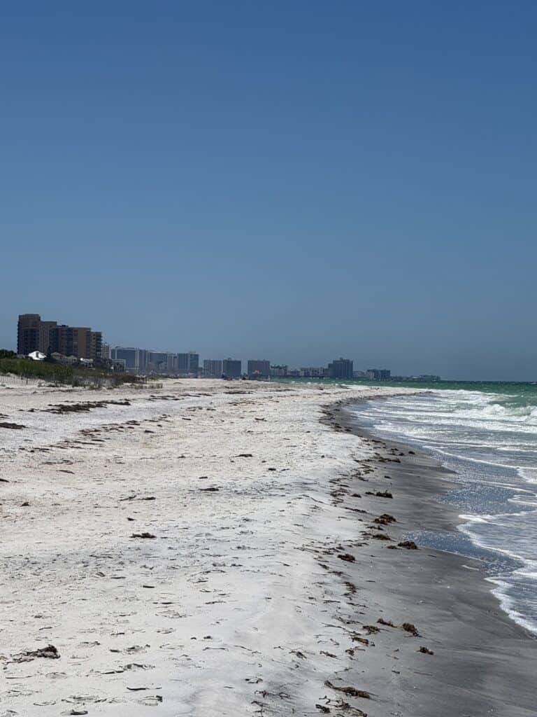
In any case, I had only about a half-mile to go to reach the end of the island, and reach it I did. For future reference, it was also here where I first saw it, looming in the distance.
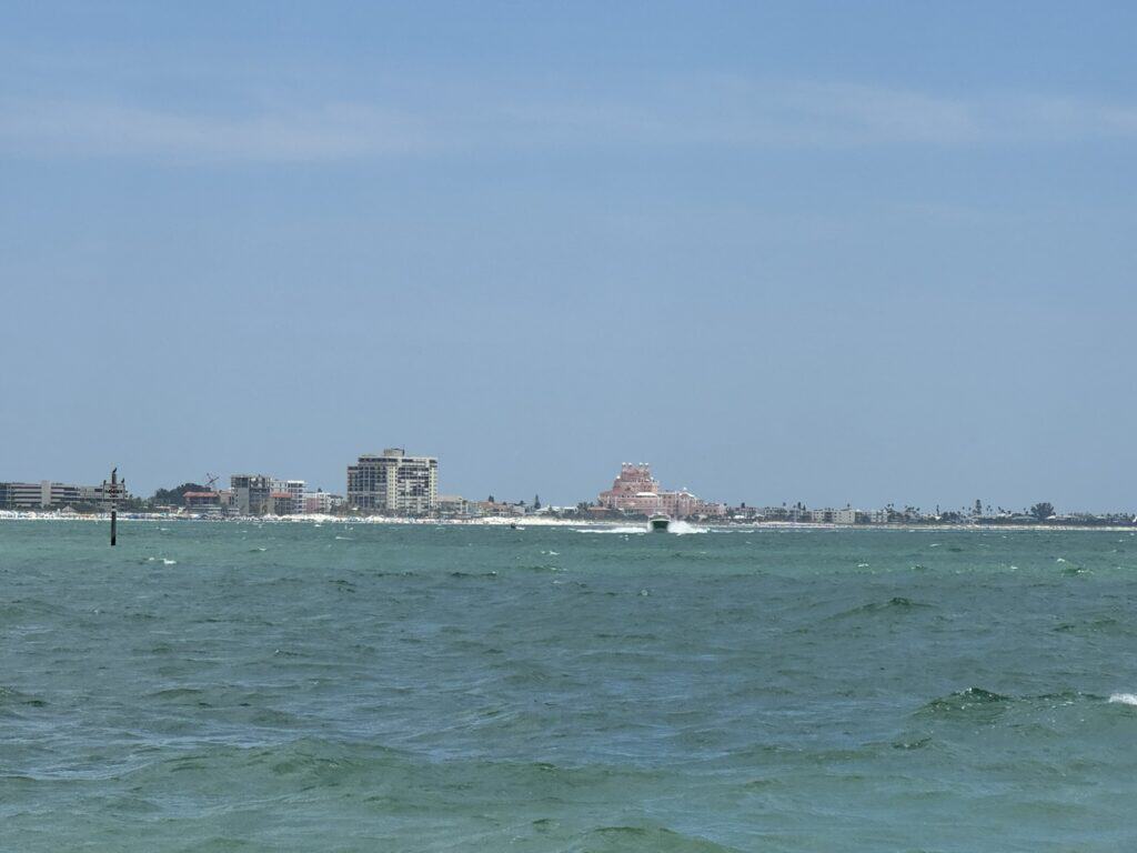
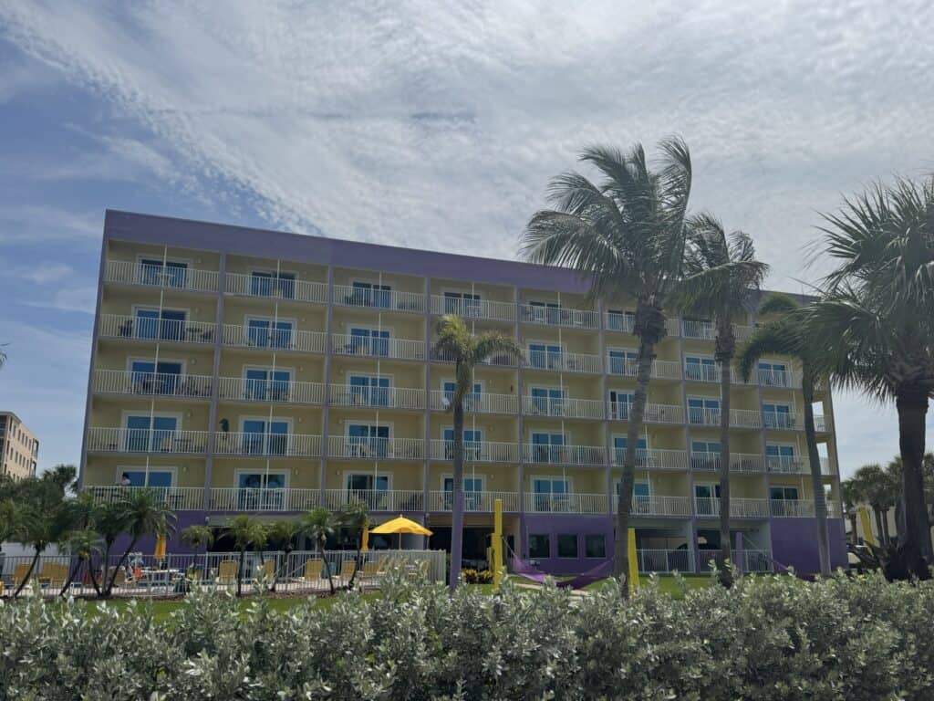
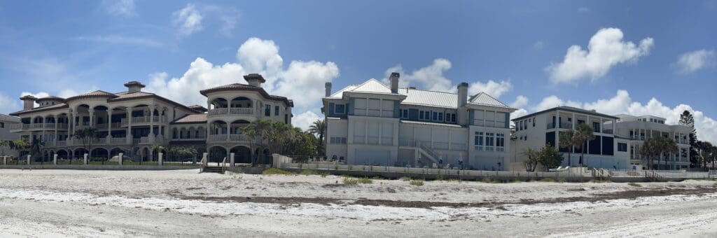
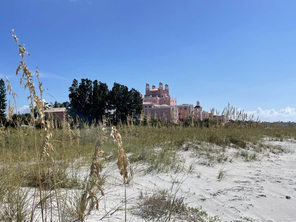
It, in this case, being the Don Cesar Hotel, which I would spend much of the rest of the day peering at off in the distance like Oz at the end of the yellow brick road. I hopped in an Uber to negotiate the crossing from Treasure Island to St. Pete Beach, and after a brief detour through the charming Corey Avenue corridor, I reemerged on the beach. 5 miles to go.
But it was getting late. Morgan was nearly on the way to meet me, and I very much wanted to finish as close as possible to her arrival to not make her wait, on top of the other sacrifices she’d be making in service of my walk – namely, sleeping outdoors on a hard pile of shells.
So, I set my eyes on the Don Cesar, put on “Aja” by Steely Dan, and walked. It began to creep closer.
And closer.
And even closer still.
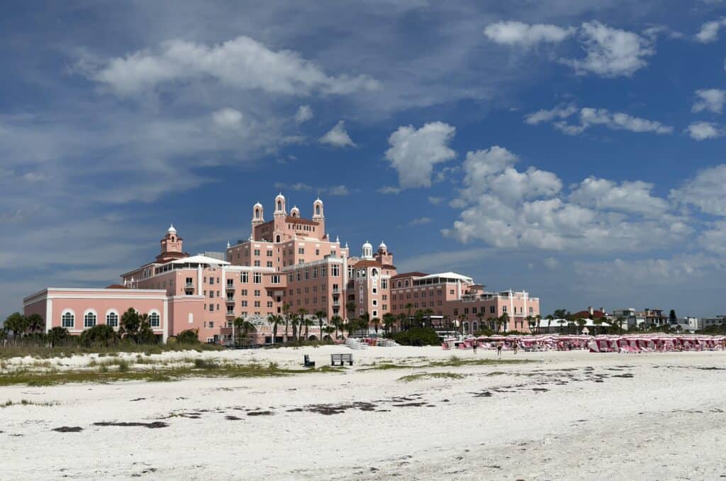
Finally, it was here. I’d spent so long staring at it. It beckoned me to come inside and explore (and had been since I first saw it in 2022), but two very important things kept me out: the clock and the fact that my sweaty, disheveled self was increasingly resembling a shipwreck victim who’d decided to take up hiking. Although it was unavoidable, it was nevertheless somewhat disappointing.

1.7 miles to go. There was nothing left to look at other than…the end. Suddenly, the buildings to my left dropped away in the distance, and the uninhabited Shell Key into view. I was going to make it, despite everything else.

With the end of the beach in sight, I caught sight of a guy waving at me as he closed the distance in a light jog. “Where are you going, man?” I described my walk and my destination, now just a stone’s throw away. He asked why I was doing it, and I did my best to explain that I was doing it mostly because it was there to do.
“Just free-willin’ it, huh?” I thought about it for a second. “Yeah, that’s a really good way to put it,” I told him. I guess that was as good an explanation as any. There were so many things I could have gotten up and done this week, and this was what I chose out of all of them. It had been sitting at the edge of my thoughts for a day or so now. I put it out of my mind; I didn’t want to be thinking about it when I reached the end of the beach.
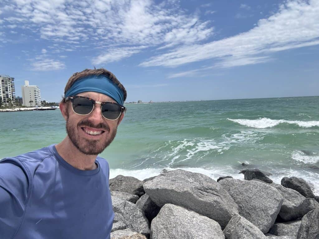
A few more steps of free will, and there I was – at the southernmost tip of the Gulf barrier island chain that stretched from Honeymoon Island to Pass-a-Grille. I wasn’t done. But I was done with something.
I took a few moments to rest as I looked out into the channel before my phone rang. Just like that, my ride was here. Morgan had arrived a few minutes before me and shuttled over to pick me up on my side of the island. “You look so sunburned!” she told me. It was good to see a friendly face. It was good to move from one place to another without walking.
Unfortunately, our challenges for the day weren’t through. My reward for my 11 miles of walking was to sleep on some very hard ground, albeit in a very beautiful place. More on the final day tomorrow.
Walking Pinellas Beaches: Day 3 – The “Bellairs” and the “Indians”
Today’s Walk
Start / End: Clearwater Beach — North Redington Beach
Distance: ~10.7 miles / 27,006 steps
Time: 7 hours, 9 minutes
Today’s Listens: “Scientist Rids the World of the Evil Curse of the Vampires” by Scientist, “Future Days” by CAN, Odd Lots podcast – “How Taiwan Became the World’s Most Perilous Geopolitical Chokepoint”
If I can be completely candid, this was not the most fun day of walking or most fun day at the beach I’ve ever had. I woke up profoundly feeling the miles from the day before, and the time spent treating my skin with aloe, CBD pain cream, and sunscreen before leaving had begun to mount. I also promptly forgot my trekking pole at the Airbnb, an inauspicious start to an 11-mile day, the longest yet.
Another ill omen: I stumble upon a gluten-free donut shop while looking for coffee. Sounds great, but these were the messiest donuts I’ve ever encountered, and I start the day sticky, sore, and off balance.
The good news is that I get to walk through what’s undeniably the most hostile stretch of beach today, too – Bellair Beach, Bellair Shore, Indian Rocks Beach, Indian Shores, and North Redington Beach.
All in all, this put me in not the greatest mood, even as I crossed one of the most breathtaking bridges of the route, Sand Key Bridge.
For a long time after we moved here, I could not keep any of these communities straight in my head at all. It doesn’t help that, along with being similarly named, these clone communities are also very similar in character, too.
In the “Bellairs”, that character can basically be summed up as, “don’t come here.” The owners of homes in these exclusive, upscale communities have worked to make it as hard as possible to access the roughly two miles of beachfront that they share, with minimal beach access and parking and next to no commercial development at all. This could not be a starker contrast to Clearwater Beach, just across Sand Key Bridge to the north.
The “Indians” offer a less extreme view of what a quieter, mostly residential Gulf town looks like, with far more options in the way of beach access, restaurants, shopping, and hotels and other rentals. I wish I could tell you more about them, but I didn’t stop.
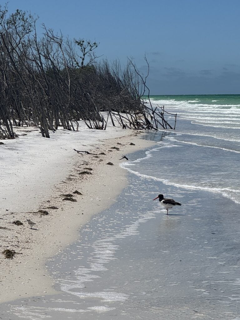
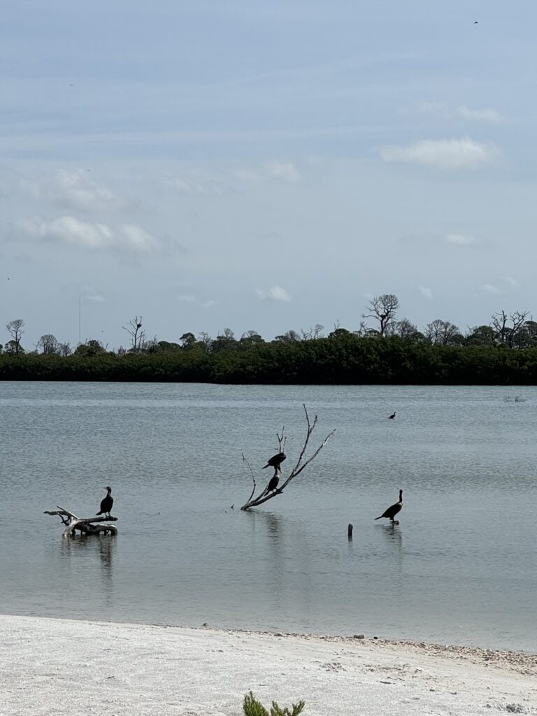
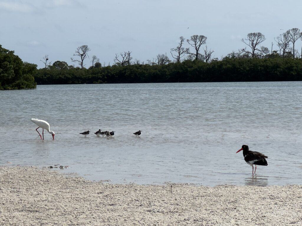
Instead, I stuck to the (mostly empty) beach, accompanied by the shuttered snowbird homes on my left, and real birds (Today’s Bird of the Day™ is the Cormorant) hanging out along the water.
Naturally, I do a good bit of research before I set off on these kind of adventures. But I can’t say I wasn’t a bit daunted when I looked ahead to the route for this day and saw the first place I could reasonably stop – for lunch, for a bathroom break, for water – was 6.8 miles from where I stayed in Clearwater.
I understand I’m quite literally in the most densely populated country in Florida, a quick Uber ride from multiple popular tourist destinations. But it’s nevertheless a bit unnerving to be at the mercy of car services if things go wrong. They’ve let me down before in highly populated beach towns; ask me sometime about how it took four college-educated adults to figure out a way to get me from LBI to Atlantic City when my Uber abandoned me.
So, in the interest of getting there, I just kept walking. And walking. And walking. After a while, I realized I was not having any fun, so I walked some more.
One of the most common questions I’ve gotten on this walk and my previous one through New Jersey was, “what are you training for?” When I typically explain that I’m not training for anything, not the Appalachian trail, not walking across country, not even the Florida Trail (someday, if I get up the nerve to walk through flooded, snake-filled swamps), the response is usually a little odd. People seem to have a hard time understanding someone would just go out and walk an area they could just drive through, for no reason other than doing it. I guess I’m not even sure why I’m doing it, other than to set a goal for myself and achieve it at a time in my life where many larger and more important things feel somewhat out of my control.
To give you a sense of the general hostility of this area to people on foot, I stopped for lunch a bit later than usual, perhaps from the heat or perhaps spurred onward by how far I still had to go. Only one problem: how to get off the beach? This is much easier said than done.
The private homes and condos went on and on, and I’d already slightly passed my target restaurant anyway. Finally, I found what looked to be an open way to the street, but after opening the (unlocked) gate from the beach, I found myself trapped between that now-locked gate and the one at the street, both of which needed codes. This, my friends, is not my idea of a good time.
Luckily, an older woman eventually came along and let me through, but not before a comment about how I shouldn’t have been in there anyway. I responded that they should lock their gates from the outside in that case, not just the inside. She didn’t seem to appreciate this feedback.
After a quick lunch in aggressive air conditioning (thank you, Caddys), I made my way back onto the beach, this time through friendlier pathways. From here, the end was in sight – 3.6 miles! That’s nothing.
(It wasn’t nothing)
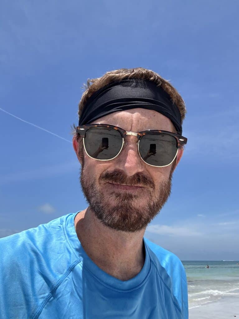
The final segment of the day was barely an hour and change, but I struggled the whole way through. The latest was sunburn, which I had impressively achieved despite using a family-sized bottle (“50% more!”) sunscreen in just three days (I promise I was wearing a hat with neck cape, despite this picture)
I may not have believed it, but my hotel eventually did appear on the horizon, and crept closer step by step. By the time I staggered into the lobby, I was ready for a shower and a long time lying down. I’m a Hilton Gold member but even the front desk didn’t trifle with their whole spiel, because I’m sure at the time I looked somewhere between a shipwreck victim and an escaped mental patient.
In spite of it all, I made it here. My shoulders and calves ache, I’ve got a blister on top of the blister I got training for this, and my face, arms, and legs are an unusual hue somewhere between a deep tan and a raging sunburn.
And just like that, I’m more than halfway through this walk. What will tomorrow bring? Hopefully, it will take me through a day that’s truly a mix of everything I’ve seen so far: tourist spots, quiet residential areas, and frustratingly similarly named small beach towns. Will I actually be able to do a slightly longer day than today, all in time to meet Morgan, set up a tent, and then sleep outside, all before doing this one final day? Truly, only time will tell. In the meantime, I’m going to have another therapeutic mojito and hope for the best.
Walking Pinellas Beaches: Day 2 – Caladesi Island and Clearwater Beach
Today’s Walk
Start / End: Tarpon Springs – Clearwater Beach
Distance: ~7.3 miles / 19,219 steps
Time: 5 hours, 1 minute
Today’s Listens: “The Campfire Headphase” by Boards of Canada, “Southern Rock Opera” by Drive-By Truckers, Audiobook: “Blue Highways” by William Least Heat-Moon
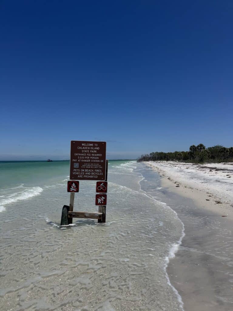
My day began on Caladesi Island, which is an island in the same sense that ketchup is a vegetable. It may have been that at one point, and people might still sometimes try to tell you that it is, but no one who experiences the real thing would make that argument.
The second of Pinellas County’s two state parks, it’s separated from Honeymoon Island by the aptly named Hurricane Pass. The two were one island until a 1921 storm (sometimes known as the Tarpon Springs hurricane; our home was built in 1922, for what it’s worth) cut the two apart with a channel that’s survived more than a century. Since the late 1980s, however, it’s been connected to Clearwater Beach to the south, as tides filled in the narrow, shallow gap that once existed between the two islands. This is good news for me, otherwise I’d be doing a good bit of backtracking, or a very ill-advised swim.
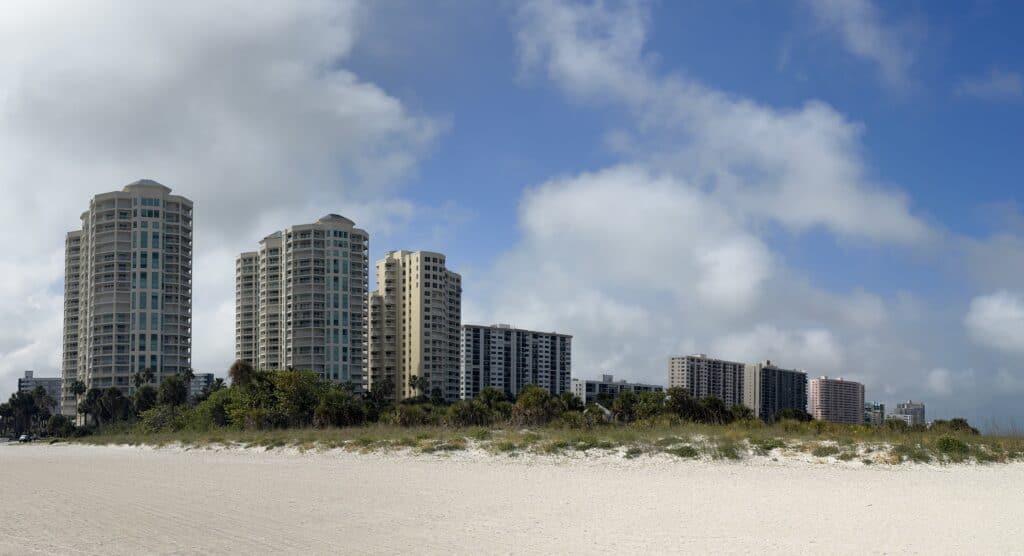
Still, the now-inaccurate name is a testament to the powers of tropical storms to completely reshape barrier islands of this size. The good thing is no one would ever think to put dozens of high-rise condos and hotels on the same eternally shifting barrier island just a few miles south.
…
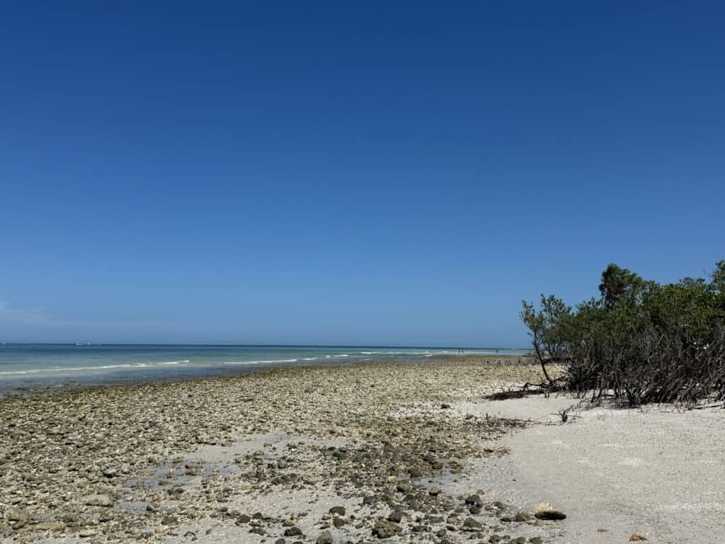
Anyway. Caladesi Island is mostly undeveloped, other than the ferry terminal where I was dropped off, which has a few services. The inaccessibility and unspoiled gulfront has been enough to earn the park accolades as one of the country’s best beaches multiple times from the (self-declared) Dr. Beach.
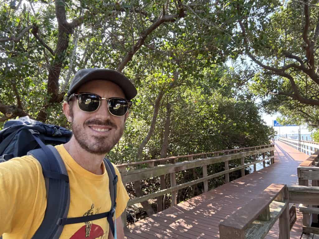
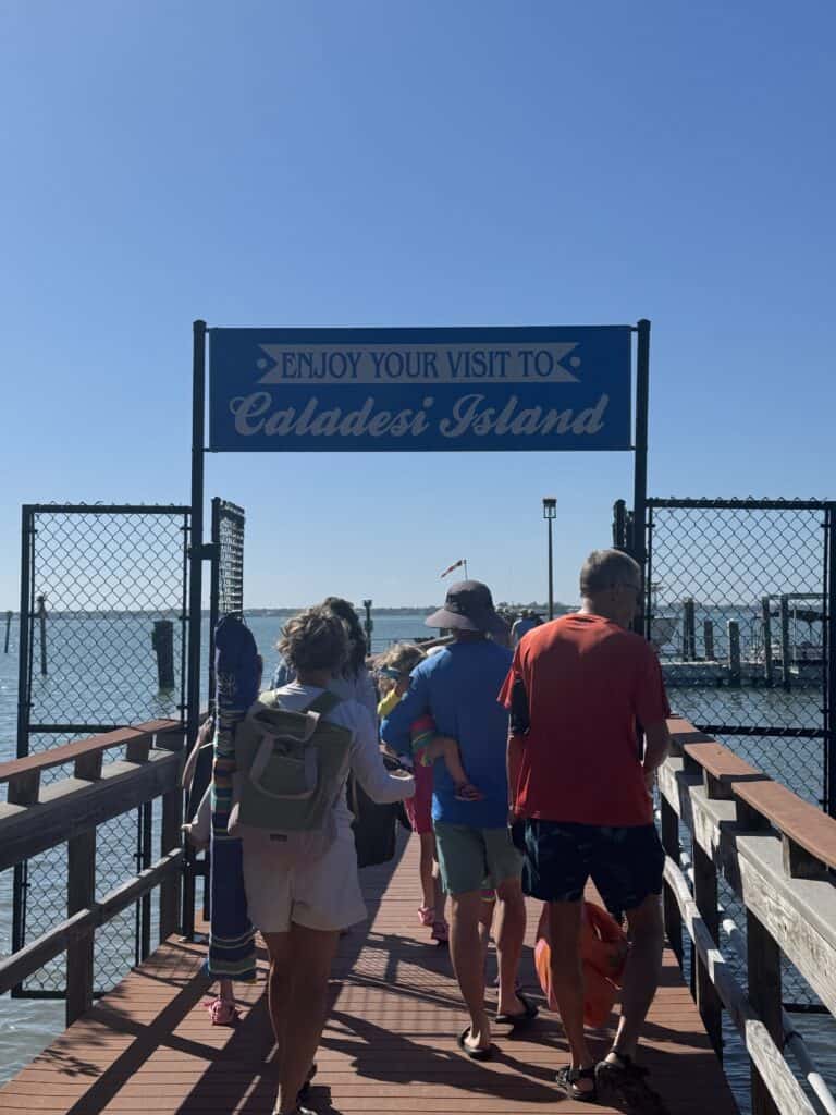
The only (official) way to get to this gorgeous place is by boat, either private or the public ferry. If you call the state park office, they will strenuously discourage you from walking. In a rare case of not trusting park rangers working out, I ignored them and thrived instead of ending up falling off a cliff or in the stomach of some animal.
The 20-minute boat ride over was beautiful, if slightly longer than necessary after someone’s bag got caught by the wind and blew off into the water. From the ferry drop-off, I headed north on what I thought was a nature trail; hey, why not see some inland areas before I spent the rest of the day on the beach? However, I learned this was decidedly not the case from signs only upon reaching the beach. Oh well – it seemed pretty to me!
I might be a professional writer, but I’m going to struggle to find ways to describe how beautiful some of these places are by the end of this. The north end of Caladesi is particularly notable because you can be, and most likely are, the only person around for miles.
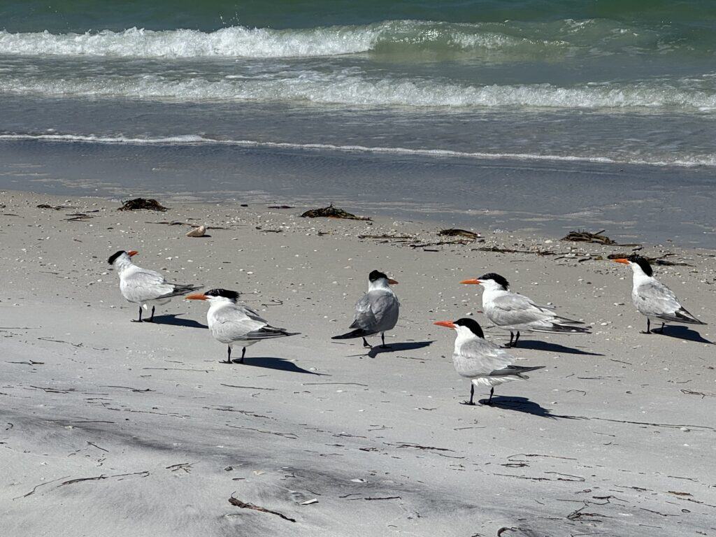
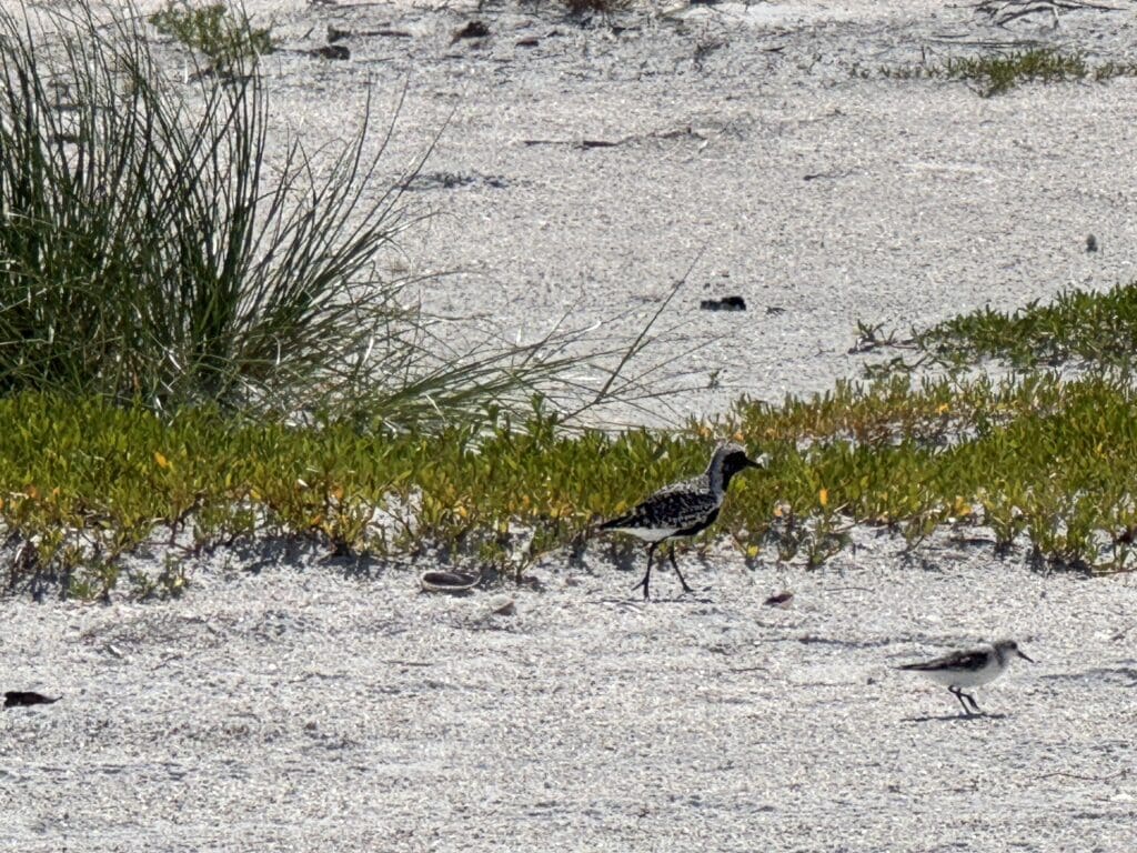
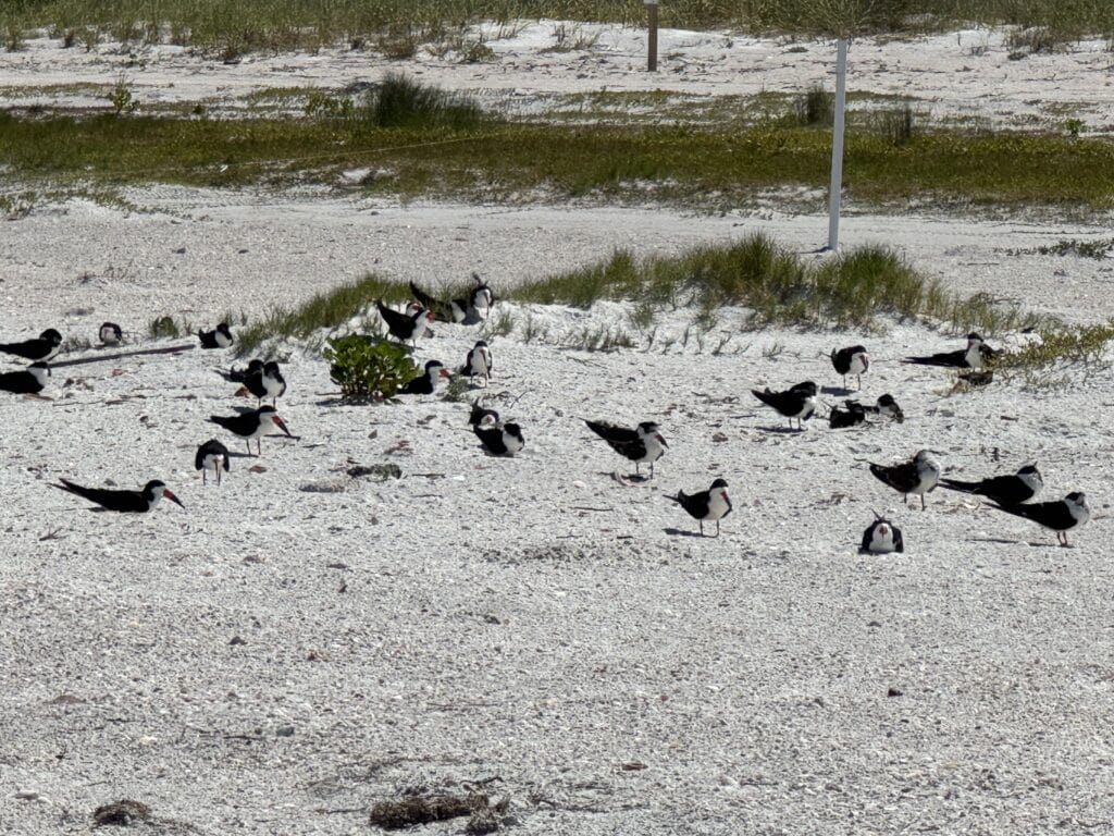
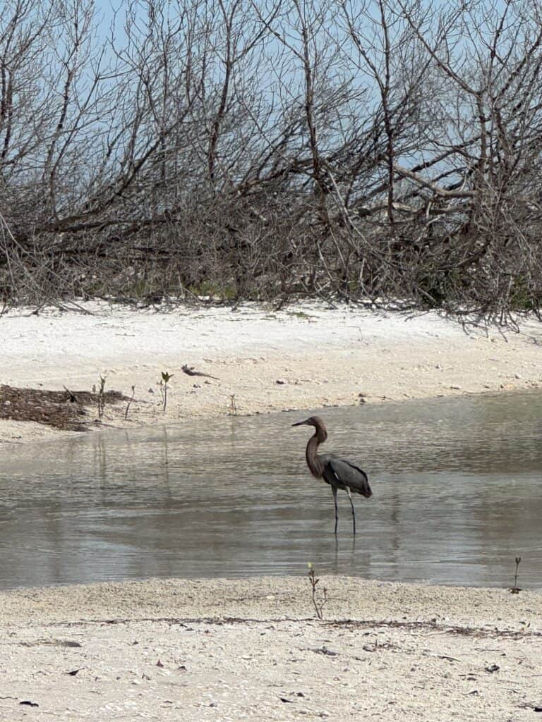
Only person, of course. My walk companions this morning were several hundred birds of varying species, surprisingly few of which I’d seen the day before. Today’s Birds of the Day™ are the Caspian tern, the black-bellied plover, and the black skimmer, which was apparently nesting in large numbers right now.
Although I would have liked to linger at the north end a little longer, time was ticking away, and it was more important than usual today. That’s because, as fake as Caladesi’s island status is, it can still get a little dicey on the walk to Clearwater. This is what that it looks like with a rising tide and a strong onshore wind.
The upshot is that, due to timing and weather issues beyond my control, I ended up walking about a third of a mile to the park boundary in knee-deep water with a heavy pack on. I do not recommend this as a matter of enjoyment, but I was able to cross safely and relatively easily. With the only real question mark of the walk behind me, I set up my umbrella and had my lunch with Clearwater in the distance.
It was around here where I had my strangest encounter of the day. I was starting to wonder if I wasn’t going to encounter the same class of characters I’d run across on the Jersey Shore. Then I remembered: I’m in Florida.
As I was relaxing after eating, struggling to (and ultimately failing at) keep my umbrella from blowing away, a middle-aged guy with no shirt and soaking wet cargo shorts who was walking up the beach gestured to me to get my attention. Because I still haven’t learned my lesson with this kind of thing, I went over.
”Do you see that thing?,” he asked me. He pointed out toward where the azure shallows turned a more emerald green. I could see what he was talking about. It was big, maybe 10-15 feet long, dark in color, and moving along at what appeared to be a steady, deliberate pace north. “Are you from around here? What is that thing?,” he asked.
I answered that I was, and that I couldn’t say – maybe a dolphin, or a manatee, or even a shark? Maybe it was even just a big piece of driftwood caught in a strong tide. None of these suggestions satisfied this man, who stood next to me in silence for a minute before announcing he was going to keep following it. I warned him the tide was coming up and the beach was already underwater further north, but he was undeterred. I wonder what happened to that guy. And I wonder what that thing was. Because he was right, it probably wasn’t anything I’d suggested.
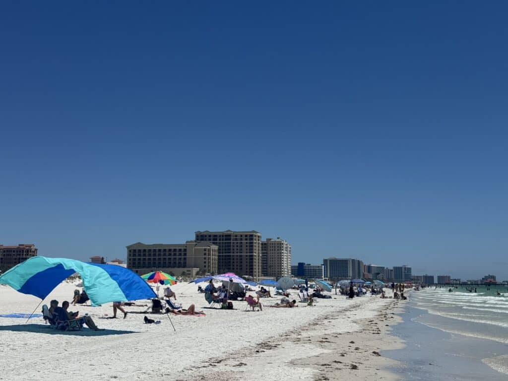
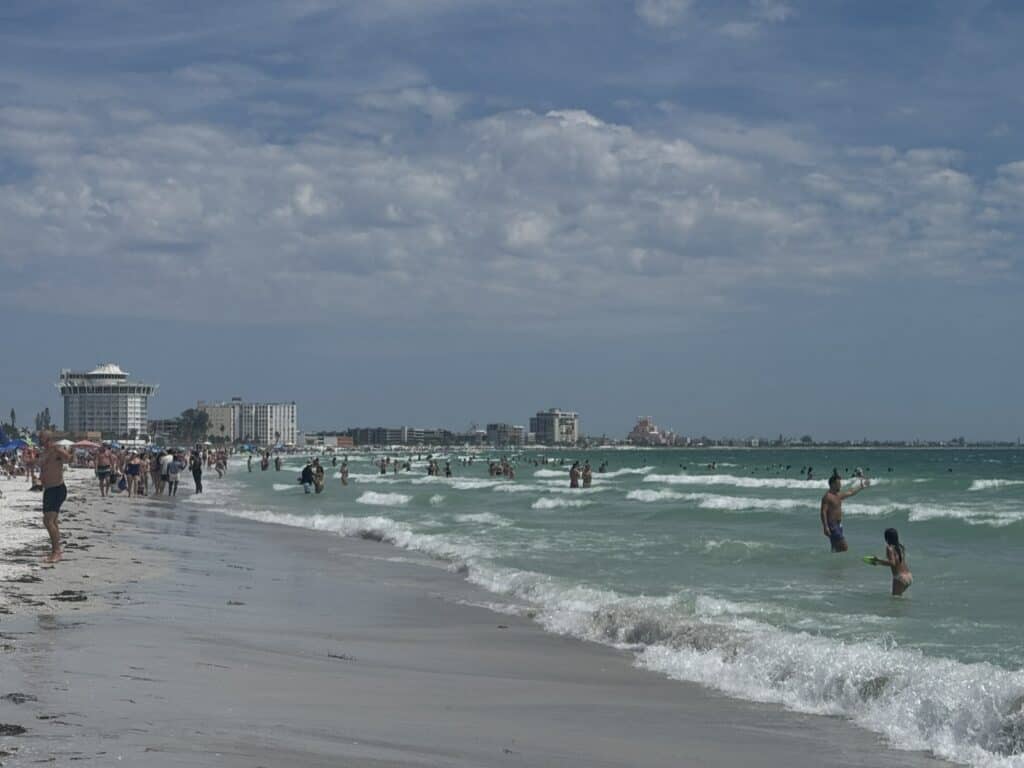
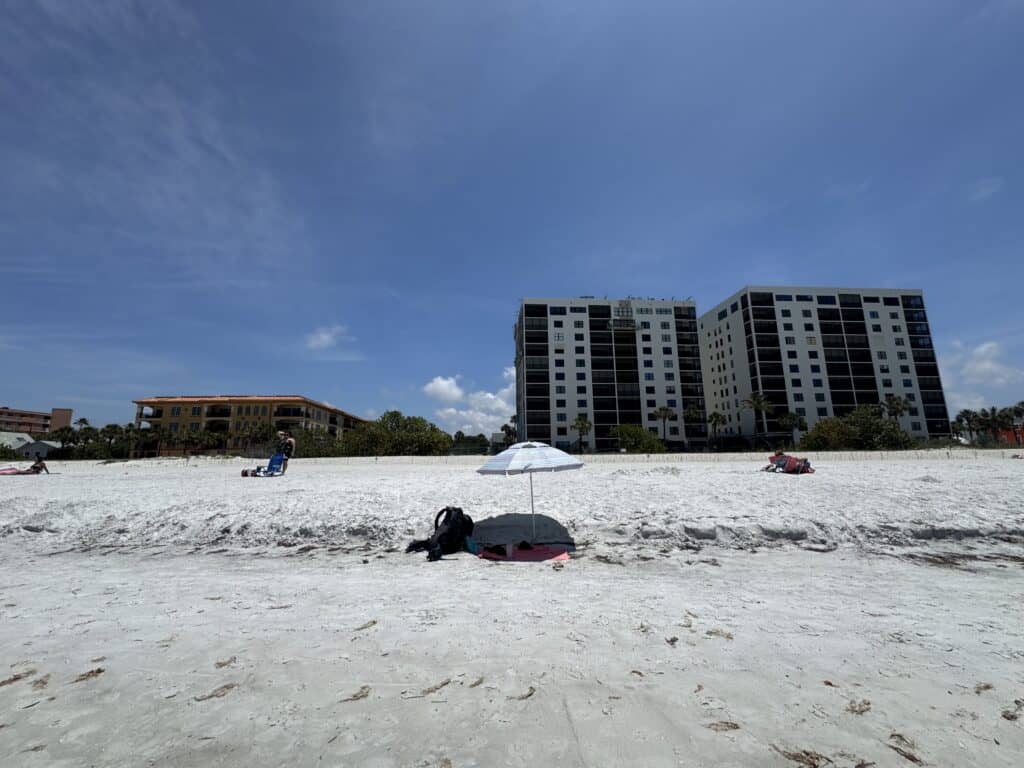
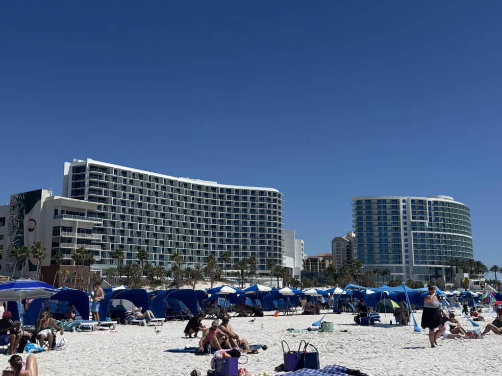
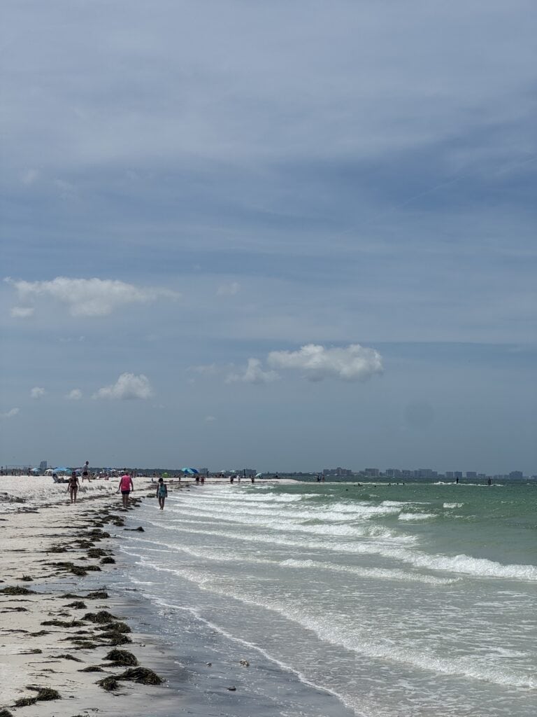
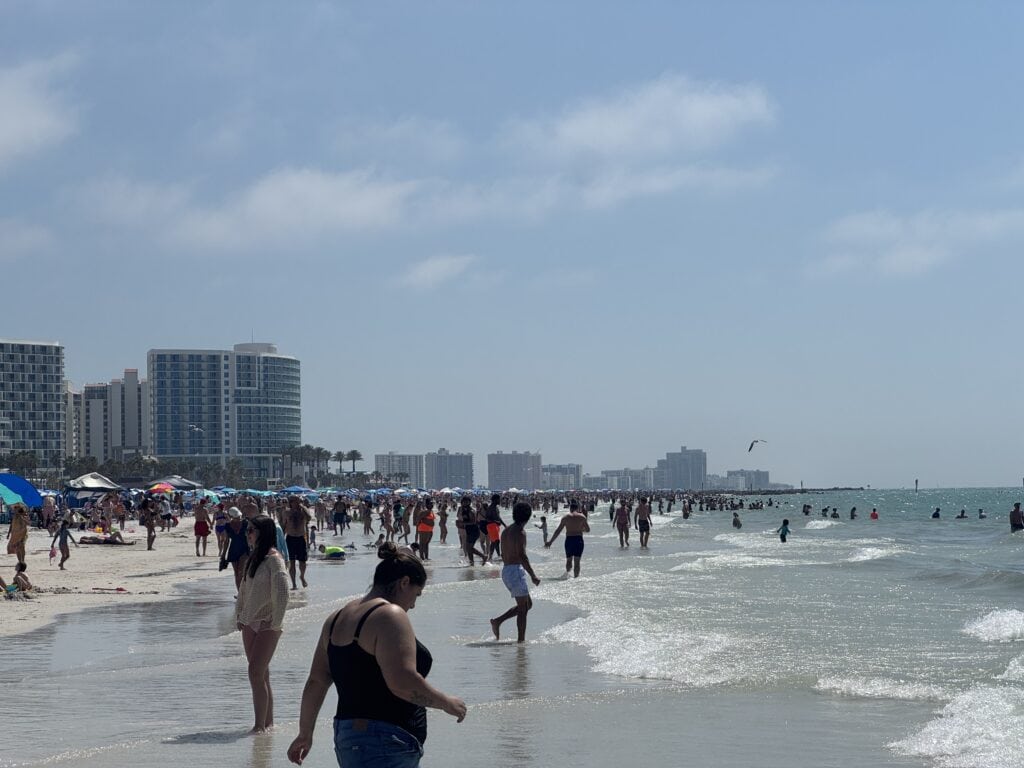
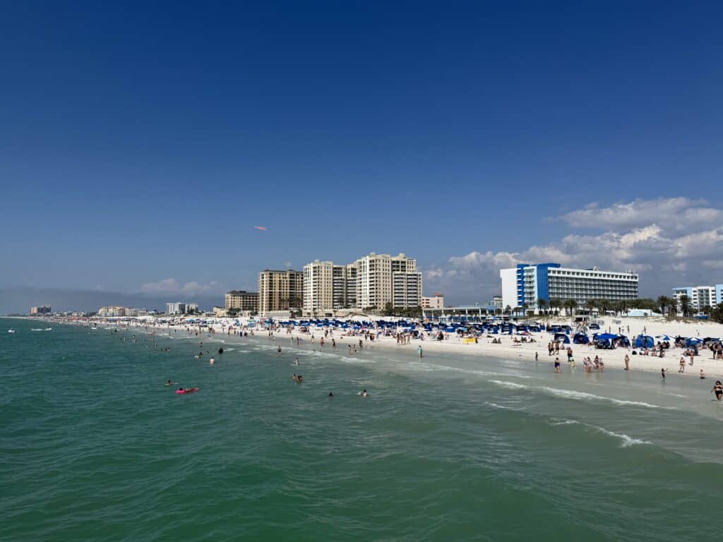
From here, it was an easy few miles logistically and beachwise. But the overall vibe could not have been more different. Clearwater Beach is easily among the most developed and most tourist-heavy parts of the entire Gulf Coast. Miles of empty sand were replaced by dozens of perfectly aligned chair-umbrella combos and hordes of southerners and midwesterners wading into the Gulf, mostly clustered around the famous Pier 60.
Still, deceptively quickly, the island came to abrupt end. All in all, I was ready. I’d had enough sun, enough people, and enough walking. My Airbnb was a short walk away, and after a shower and a nap, I took in the sunset from Jimmy’s Crows Nest, a rooftop bar that would have provided one of the best sunset experiences of all time if not for the choice in music (“Wonderwall” at sunset for a bunch of boomers? What are you guys doing?).
Another day down, and the only main wildcard now settled. From here on, all I’ve got to do is walk. I’ll be doing plenty of that tomorrow on Day 3, where I’ll tackle some of the lesser-known Pinellas County beach communities, and likely spend a good deal of time wondering why they are named so similarly.
Walking Pinellas Beaches: Day 1 – Honeymoon Island State Park
Today’s Walk
Start / End: Tarpon Springs – Tarpon Springs
Distance: ~5.7 mi / 14,409 steps
Time: 4 hours, 4 minutes
Today’s listens: “Long Season” by Fishmans, “Hejira” by Joni Mitchell, Odd Lots podcast – “Understanding the Most Viral Chart in Artificial Intelligence”
Compared to my last long walk, this one feels like it has a bit of a false start. Tonight, I’m back at home, writing to you from my couch after completing my first day of walking along the shore of Honeymoon Island State Park. Yes, there are plenty of places to stay around the park in charming Dunedin, and plenty of people do. But it’s hard to justify the expense (and terrible pillows) when this highly underrated piece of Gulf Coast is just 25 minutes from our door.
Outside of our two small but respectable local beaches in Tarpon Springs, Honeymoon Island is our closest “real” beach, and I feel very grateful to have this unusually intact piece of nature nearby.
Once known as the decidedly less romantic Hog Island, the park earned its current name from a short-lived promotion in the 1940s offering stays at cottages on the island to newlyweds. Thanks to a combination of incompetence from developers and protection efforts from local environmentalists, it never suffered the fate of so many barrier islands in Florida, packed to the brim with homes and high-rises. It’s been part of the Florida state park system since the early 1980s, and in my opinion, it’s one of the best combinations of natural beauty, accessibility, and environmental protection of any beach I’ve seen.
So, unlike some upcoming days along this walk, my stroll today was along a nearly entirely undeveloped stretch of coastline, curving northwest from St. Joseph Sound to the Gulf.
I’ve been here a fair number of times before, so I wasn’t expecting any surprises today. Still, barrier islands have a way of surprising you. It’s obvious to anyone who visits that Honeymoon Island is being actively shaped by some pretty strong tides and currents. In between prominent points supported by breakwaters, the beach deeply curves inward repeatedly. Depending on the tides, this can create mini sandbars around the rows of rocks used to prevent further beach erosion. On a more practical level, it creates little private areas for people willing to get there early.
For relatively long stretches of the walk, it was just me and the many birds that call Honeymoon Island and the surrounding area home. I saw anhingas, reddish egrets, oystercatchers, ibises, terns, ospreys, and, from afar, one of the park’s prized bald eagle nests. It should be no surprise that Honeymoon Island is an important local part of the Florida Birding Trail, and has been an important part in turning me into, as Morgan puts it, a “bird guy.”
After a few miles of walking north, I hit water in a place I wouldn’t have when I first visited the park in late 2022, a few months after moving here. The northernmost point of the walk would have to be here, rather than the “true” end of Honeymoon Island, or North Honeymoon Island as it might rightfully now be called. The islands split naturally in early 2024, although I have to imagine two near-misses from strong hurricanes that year probably helped widen and deepen the new channel.
Here at the end of the park, there were just a few other intrepid souls who made the walk, and me. Spend enough time walking on beaches, and you’ll quickly learn that most people seem constitutionally incapable of setting up more than 300 yards from the entrance from the parking lot, meaning you end up with absurdly packed clusters separated by huge, empty gaps.
This felt like a particularly appropriate north end of the walk. From here, I could see all the way back to Tarpon Springs, and beyond into Pasco County. I rested here for a while, hesitant to leave this peaceful place and the few people who’d made it up there (including a guy who’d set up on an increasingly shrinking sandbar), but it was time to turn around and head south.
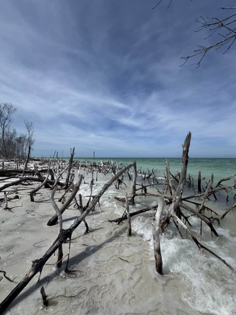
Retracing your steps is never the most fun of a beach walk, especially when it involves voluntarily picking your way through dead mangroves in calf-deep water (there was a reason for this decision, I promise).
But, in the spirit of using the day as a warm-up day, I decided to check my pace and test out some equipment I hadn’t used since my last beach walk five years ago. Pacewise, my 35-year-old legs haven’t fallen off too much from what my 30-year-old ones could do (with a lot more training) back in Jersey in 2021. I’d be lying if I said I wasn’t a bit concerned about how I’ll feel after a few days of doing this, but that’s a problem for three days from now. In any case, part of this walk is proving that I still can do this (and doing it before I can’t).
Five years is also enough time to forget why I didn’t use certain equipment on the second half of my Jersey beach walk. After struggling for 20 minutes or so to set up my portable beach canopy in a very mild wind, I recalled the fact that this thing is basically useless in anything stronger than a light breeze. Alright – lesson learned; it’ll be staying at home, and I’ll be coming up with another portable shade solution so I don’t end up lightly charred by the end of this trip.
Honeymoon Island’s southern tip is set aside as a pet beach, and there is usually more joy in this small section than the rest of the park combined. Unfortunately, early afternoon Wednesday is apparently not a peak time for taking your pets to the beach (although, why not? It’s not as if most people around here have jobs, anyway), and there were few witnesses (on two or four legs) to the completion of the day’s walk.
So, one day down. For most of my walk south, my path for tomorrow was visible in the distance. In fact, it’s just across the water in that final video above. Tomorrow, I confront the only real challenge that’s given me any sort of pause on this journey. That’s walking from one “island” to “another.” I’ll explain more in my next post, when I’ll explore Caladesi Island State Park and Clearwater Beach.
Another Long Walk: Five Years Later
Some of you very likely remember Morgan and my adventures four years ago, as we traveled from DC across the country and back, searching for a new place to call home. But true original Road Goes on Forever readers will remember this blog actually started for a different purpose.
In early 2021, in the wake of a pandemic and, at 30 years old, in the first semi-involuntary period of unemployment of my life, I was inspired to take a long walk by the now-late Washington Post reporter Neil King. It came down to the random chance of seeing a Twitter post by King, mentioning he was heading out of DC on a walk to New York City (you can read about his walk in his book, American Ramble).
To this day, I’m not sure why the idea resonated with me so much. I was certainly aware of the idea that people walked long distances, but it may have been the idea that this wasn’t some done-to-death path like the Appalachian Trail, and that for the first time in my adult life, I had the time to attempt something like this.
The inspiration came from my parents’ decision to sell the home I grew up in in northwestern New Jersey and move to Florida. Over the decade since I’d graduated from college, I’d fallen out of touch with most of my hometown friends, and even increasing numbers of my family were giving up on the Garden State and New York and moving (where else?) to Florida. For this reason, it only seemed to make sense to see, in depth, the one part of the state I’d always liked but never spent a ton of time exploring: the shore.
So, I did it. Over the course of two separate weeks, I walked from Cape May to Atlantic City, then from Sandy Hook to Atlantic City, just as the shore was beginning to fully reopen post-COVID. It was one of the most memorable and rewarding experiences of my life, despite a hurricane, multiple near-strandings in random corners of the shore, persistent harassment by New Jersey teenagers (in both official and non-official capacities), and even a run-in with the law on the very first day that almost made me miss the ferry from Delaware. Maybe I’ll actually write about it all sometime, I still have my journals.
Well, it’s five years later, and here I am, this time fully involuntarily unemployed. Maybe I’ll talk more about that later; maybe not. But this time, there’s no need to concoct an idea, as this one’s been brewing for a while. And the logistics are a lot easier, living two miles from the Gulf of Mexico instead of the hours-long trip from DC to New Jersey. Plus, with summer looming, there’s no time to waste.
So later this week, I’ll be walking the length of the beaches of Pinellas County, my home for the last nearly four years. When we last left you, we had just settled here in Tarpon Springs, a relatively abrupt stop to 13 months of constant motion. It has been an up-and-down four years in many regards, but our love for our new home hasn’t wavered.
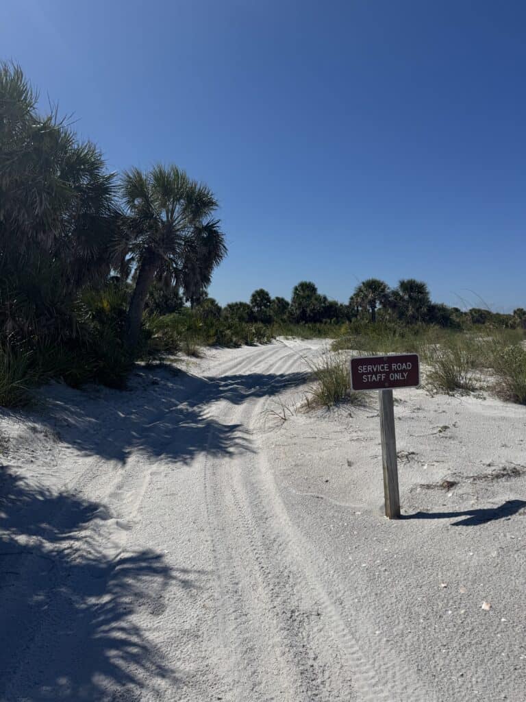
In our little peninsula-on-a-peninsula, we’re lucky enough to have two quiet beaches in our town (Fred Howard Park, operated by Pinellas County, and Sunset Beach, owned by the city), with the rest of the county’s world-famous beaches – including Clearwater Beach, Pass-a-Grille, and others – further south. Two state parks make up significant parts of our coastline (Honeymoon Island State Park and Caladesi Island State Park), while the award-winning, county-owned Fort Desoto Park sits at the mouth of Tampa Bay, offering some of the region’s only easily-accessible beachfront camping.
I’ll be seeing (very nearly) it all over a five-day, 45-mile trek, starting this Wednesday:
- Wednesday: Honeymoon Island
- Thursday: Caladesi Island to Clearwater Beach
- Friday: Clearwater Beach to North Redington Beach
- Saturday: North Redington Beach to Pass-a-Grille
- Sunday: Fort De Soto Park
I’ve seen a decent amount of this, in parts. But my 2021 Jersey Shore walk taught me that there’s no substitute for seeing it all, because the gaps and transition zones are as important as the sights and attractions.
I hope you’ll follow as I post my daily updates on what I’m seeing and learning about this beautiful part of the country.